Luc-sur-Orbieu geodata
Luc-sur-Orbieu (Occitanie) is a populated place; located in France in Europe/Paris (GMT+2) time zone. With population of 841 people, there are 10174 cities with bigger population in this country. Compared to other cities in France, 97.4% of cities are located further ↑North; 54.7% of cities are located further ←West and 82.2% of cities have higher elevation than Luc-sur-Orbieu. Note1
Administrative division(s):
- Level 1: Occitanie
- Level 2: Département de l'Aude
- Level 3: Arrondissement de Narbonne
- Level 4: Luc-sur-Orbieu


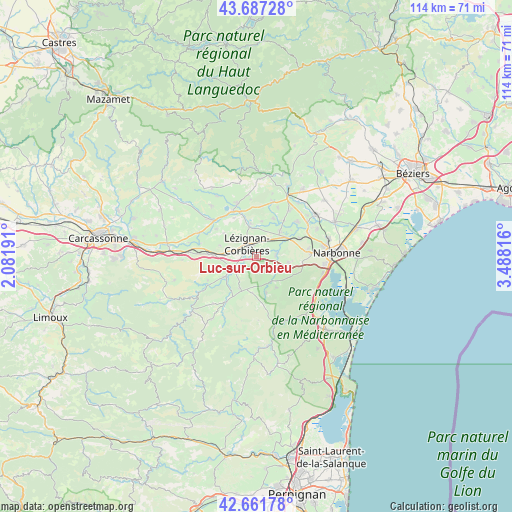
Luc-sur-Orbieu GPS coordinates[2]
43° 10' 36.048" North, 2° 47' 6.108" East
| Map corner | latitude | longitude |
|---|---|---|
| Upper-left | 43.68728°, | 2.08191° |
| Center: | 43.17668°, | 2.78503° |
| Lower-right: | 42.66178°, | 3.48816° |
| Map W x H: | 114×114 km | = 70.8×70.8mi |
| max Lat: | 51.07786° ⇑97.4% North |
| Luc-sur-Orbieu: | 43.17668° |
| min Lat: | ⇓2.6% South 41.3874° |
| min Long | Luc-sur-Orbieu | max Long |
| -5.08615° | 2.78503° | 9.52242° |
| W 54.7%⇐ | ⇒45.3% E |
Elevation
Elevation of Luc-sur-Orbieu is 49 m = 161 ft, and this is 144.7 m = 475 ft below average elevation for this country.
| Max E: |
2333 m = 7654 ft | 82.2% |
| Avg. | 193.7 m = 635 ft | |
| Luc-sur-Orbieu | 49 m = 161 ft | |
Min E: |
-1 m = -3 ft | 17.8% |
See also: France elevation on elevation.city.
Geographical zone
Luc-sur-Orbieu is located in North temperate zone (between Tropic of Cancer and the Arctic Circle). Distance of this Northern Tropic circle is 2194.9 km =1363.8 mi to South.| Distance of | km | miles | from Luc-sur-Orbieu |
|---|---|---|---|
| North Pole | 5206.3 | 3235 | to North |
| Arctic Circle | 2600.4 | 1615.8 | to North |
| Tropic Cancer | 2194.9 | 1363.8 | to South |
| Equator | 4800.8 | 2983.1 | to South |


Nearby cities:
15 places around Luc-sur-Orbieu: (largest is in red/bold)
• Bizanet
7.1 km =4.4 mi,  101°
101°
• Boutenac
3.3 km =2.1 mi,  171°
171°
• Canet
7.6 km =4.7 mi,  42°
42°
• Conilhac-Corbières
5.8 km =3.6 mi,  283°
283°
• Fabrezan
8.4 km =5.2 mi,  237°
237°
• Ferrals-les-Corbières
5.1 km =3.2 mi,  234°
234°
• Homps
11.3 km =7 mi,  332°
332°
• Lézignan-Corbières
3 km =1.9 mi,  320°
320°
• Moux
10.7 km =6.6 mi,  271°
271°
• Névian
10.3 km =6.4 mi,  67°
67°
• Ornaisons
4.2 km =2.6 mi,  84°
84°
• Saint-André-de-Roquelongue
8 km =5 mi,  148°
148°
• Sainte-Valière
11.6 km =7.2 mi,  23°
23°
• Thézan-des-Corbières
8.7 km =5.4 mi,  189°
189°
• Ventenac-en-Minervois
10.5 km =6.5 mi, 39°
Sources, notices
• [Note1] Compared only with cities in France existing in our database
• [Src1] Map data: © OpenStreetMap contributors (CC-BY-SA)
• [Src2] Other city data from geonames.org with taken over terms of usage.
• [Src3] Geographical zone / Annual Mean Temperature by Robert A. Rohde @ Wikipedia
