Herm geodata
Herm (Nouvelle-Aquitaine) is a populated place; located in France in Europe/Paris (GMT+2) time zone. With population of 853 people, there are 10054 cities with bigger population in this country. Compared to other cities in France, 89% of cities are located further ↑North; 89.5% of cities are located further →East and 76.2% of cities have higher elevation than Herm. Note1
Administrative division(s):
- Level 1: Nouvelle-Aquitaine
- Level 2: Landes
- Level 3: Arrondissement de Dax
- Level 4: Herm


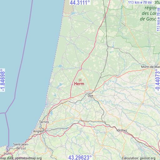
Herm GPS coordinates[2]
43° 48' 20.952" North, 1° 8' 37.896" West
| Map corner | latitude | longitude |
|---|---|---|
| Upper-left | 44.3111°, | -1.84698° |
| Center: | 43.80582°, | -1.14386° |
| Lower-right: | 43.29623°, | -0.44073° |
| Map W x H: | 112.8×112.8 km | = 70.1×70.1mi |
| max Lat: | 51.07786° ⇑89% North |
| Herm: | 43.80582° |
| min Lat: | ⇓11% South 41.3874° |
| min Long | Herm | max Long |
| -5.08615° | -1.14386° | 9.52242° |
| W 10.5%⇐ | ⇒89.5% E |
Elevation
Elevation of Herm is 64 m = 210 ft, and this is 129.7 m = 426 ft below average elevation for this country.
| Max E: |
2333 m = 7654 ft | 76.2% |
| Avg. | 193.7 m = 635 ft | |
| Herm | 64 m = 210 ft | |
Min E: |
-1 m = -3 ft | 23.8% |
See also: France elevation on elevation.city.
Geographical zone
Herm is located in North temperate zone (between Tropic of Cancer and the Arctic Circle). Distance of this Northern Tropic circle is 2264.8 km =1407.3 mi to South.| Distance of | km | miles | from Herm |
|---|---|---|---|
| North Pole | 5136.3 | 3191.5 | to North |
| Arctic Circle | 2530.4 | 1572.3 | to North |
| Tropic Cancer | 2264.8 | 1407.3 | to South |
| Equator | 4870.8 | 3026.6 | to South |


Nearby cities:
15 places around Herm: (largest is in red/bold)
• Castets
8.5 km =5.3 mi,  358°
358°
• Dax
12.9 km =8 mi,  145°
145°
• Laluque
13.1 km =8.1 mi,  66°
66°
• Linxe
15.1 km =9.4 mi,  327°
327°
• Léon
14.8 km =9.2 mi,  302°
302°
• Magescq
6.4 km =4 mi,  245°
245°
• Mées
11.6 km =7.2 mi,  166°
166°
• Narrosse
15.8 km =9.8 mi,  135°
135°
• Rivière-Saas-et-Gourby
14 km =8.7 mi,  181°
181°
• Saint-Geours-de-Maremne
14.7 km =9.1 mi,  207°
207°
• Saint-Paul-lès-Dax
11.5 km =7.1 mi, 139°
• Saint-Vincent-de-Paul
13 km =8.1 mi,  121°
121°
• Seyresse
15.2 km =9.4 mi, 154°
• Soustons
15.9 km =9.9 mi, 248°
• Tercis-les-Bains
15.3 km =9.5 mi, 168°
Sources, notices
• [Note1] Compared only with cities in France existing in our database
• [Src1] Map data: © OpenStreetMap contributors (CC-BY-SA)
• [Src2] Other city data from geonames.org with taken over terms of usage.
• [Src3] Geographical zone / Annual Mean Temperature by Robert A. Rohde @ Wikipedia
