Carspach geodata
Carspach (Grand Est) is a populated place; located in France in Europe/Paris (GMT+2) time zone. With population of 1,773 people, there are 5349 cities with bigger population in this country. Compared to other cities in France, 52.9% of cities are located further ↓South; 95.8% of cities are located further ←West and 82.8% of cities have lower elevation than Carspach. Note1
Administrative division(s):
- Level 1: Grand Est
- Level 2: Haut-Rhin
- Level 3: Altkirch
- Level 4: Carspach


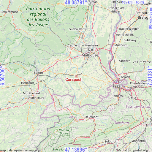
Carspach GPS coordinates[2]
47° 36' 57.888" North, 7° 12' 36.648" East
| Map corner | latitude | longitude |
|---|---|---|
| Upper-left | 48.08791°, | 6.50706° |
| Center: | 47.61608°, | 7.21018° |
| Lower-right: | 47.13996°, | 7.91331° |
| Map W x H: | 105.4×105.4 km | = 65.5×65.5mi |
| max Lat: | 51.07786° ⇑47.1% North |
| Carspach: | 47.61608° |
| min Lat: | ⇓52.9% South 41.3874° |
| min Long | Carspach | max Long |
| -5.08615° | 7.21018° | 9.52242° |
| W 95.8%⇐ | ⇒4.2% E |
Elevation
Elevation of Carspach is 320 m = 1050 ft, and this is 126.3 m = 414 ft above average elevation for this country.
| Max E: |
2333 m = 7654 ft | 17.2% |
| Carspach | 320 m 1050 ft | |
| Avg. | 193.7 m = 635 ft | |
Min E: |
-1 m = -3 ft | 82.8% |
See also: France elevation on elevation.city.
Geographical zone
Carspach is located in North temperate zone (between Tropic of Cancer and the Arctic Circle). Distance of this North polar circle is 2106.8 km =1309.1 mi to North.| Distance of | km | miles | from Carspach |
|---|---|---|---|
| North Pole | 4712.7 | 2928.3 | to North |
| Arctic Circle | 2106.8 | 1309.1 | to North |
| Tropic Cancer | 2688.5 | 1670.6 | to South |
| Equator | 5294.4 | 3289.8 | to South |


Nearby cities:
15 places around Carspach: (largest is in red/bold)
• Altkirch
2.4 km =1.5 mi,  67°
67°
• Aspach
3.4 km =2.1 mi,  30°
30°
• Ballersdorf
3.8 km =2.4 mi,  283°
283°
• Balschwiller
6.8 km =4.2 mi,  333°
333°
• Dannemarie
7 km =4.3 mi, 283°
• Hagenbach
5.4 km =3.4 mi,  313°
313°
• Heidwiller
5.3 km =3.3 mi,  24°
24°
• Heimersdorf
5.4 km =3.4 mi,  154°
154°
• Hirsingue
4.5 km =2.8 mi,  134°
134°
• Hirtzbach
2.2 km =1.4 mi,  155°
155°
• Luemschwiller
7.2 km =4.5 mi,  53°
53°
• Spechbach-le-Bas
6.2 km =3.9 mi,  12°
12°
• Tagolsheim
6.4 km =4 mi,  44°
44°
• Walheim
5.2 km =3.2 mi,  55°
55°
• Wittersdorf
4.9 km =3 mi,  82°
82°
Sources, notices
• [Note1] Compared only with cities in France existing in our database
• [Src1] Map data: © OpenStreetMap contributors (CC-BY-SA)
• [Src2] Other city data from geonames.org with taken over terms of usage.
• [Src3] Geographical zone / Annual Mean Temperature by Robert A. Rohde @ Wikipedia
