Wittersdorf geodata
Wittersdorf (Grand Est) is a populated place; located in France in Europe/Paris (GMT+2) time zone. With population of 730 people, there are 11410 cities with bigger population in this country. Compared to other cities in France, 53% of cities are located further ↓South; 96.3% of cities are located further ←West and 80.4% of cities have lower elevation than Wittersdorf. Note1
Administrative division(s):
- Level 1: Grand Est
- Level 2: Haut-Rhin
- Level 3: Altkirch
- Level 4: Wittersdorf


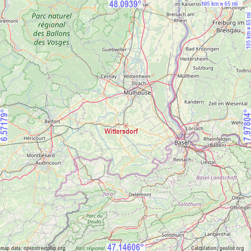
Wittersdorf GPS coordinates[2]
47° 37' 19.668" North, 7° 16' 29.712" East
| Map corner | latitude | longitude |
|---|---|---|
| Upper-left | 48.0939°, | 6.57179° |
| Center: | 47.62213°, | 7.27492° |
| Lower-right: | 47.14606°, | 7.97804° |
| Map W x H: | 105.4×105.4 km | = 65.5×65.5mi |
| max Lat: | 51.07786° ⇑47% North |
| Wittersdorf: | 47.62213° |
| min Lat: | ⇓53% South 41.3874° |
| min Long | Wittersdorf | max Long |
| -5.08615° | 7.27492° | 9.52242° |
| W 96.3%⇐ | ⇒3.7% E |
Elevation
Elevation of Wittersdorf is 294 m = 965 ft, and this is 100.3 m = 329 ft above average elevation for this country.
| Max E: |
2333 m = 7654 ft | 19.6% |
| Wittersdorf | 294 m 965 ft | |
| Avg. | 193.7 m = 635 ft | |
Min E: |
-1 m = -3 ft | 80.4% |
See also: France elevation on elevation.city.
Geographical zone
Wittersdorf is located in North temperate zone (between Tropic of Cancer and the Arctic Circle). Distance of this North polar circle is 2106.1 km =1308.7 mi to North.| Distance of | km | miles | from Wittersdorf |
|---|---|---|---|
| North Pole | 4712 | 2927.9 | to North |
| Arctic Circle | 2106.1 | 1308.7 | to North |
| Tropic Cancer | 2689.2 | 1671 | to South |
| Equator | 5295.1 | 3290.2 | to South |


Nearby cities:
15 places around Wittersdorf: (largest is in red/bold)
• Altkirch
2.7 km =1.7 mi,  274°
274°
• Aspach
3.8 km =2.4 mi,  305°
305°
• Carspach
4.9 km =3 mi,  262°
262°
• Frœningen
6.8 km =4.2 mi,  354°
354°
• Grentzingen
6.7 km =4.2 mi,  164°
164°
• Heidwiller
4.9 km =3 mi,  327°
327°
• Heimersdorf
6.1 km =3.8 mi,  204°
204°
• Hirsingue
4.2 km =2.6 mi, 203°
• Hirtzbach
4.8 km =3 mi,  236°
236°
• Illfurth
5.8 km =3.6 mi, 353°
• Luemschwiller
3.7 km =2.3 mi,  14°
14°
• Spechbach-le-Bas
6.4 km =4 mi, 326°
• Steinbrunn-le-Haut
6.9 km =4.3 mi,  52°
52°
• Tagolsheim
3.9 km =2.4 mi,  355°
355°
• Walheim
2.4 km =1.5 mi, 346°
Sources, notices
• [Note1] Compared only with cities in France existing in our database
• [Src1] Map data: © OpenStreetMap contributors (CC-BY-SA)
• [Src2] Other city data from geonames.org with taken over terms of usage.
• [Src3] Geographical zone / Annual Mean Temperature by Robert A. Rohde @ Wikipedia
