Schirrhein geodata
Schirrhein (Grand Est) is a populated place; located in France in Europe/Paris (GMT+2) time zone. With population of 2,175 people, there are 4413 cities with bigger population in this country. Compared to other cities in France, 75.6% of cities are located further ↓South; 99.4% of cities are located further ←West and 50.8% of cities have lower elevation than Schirrhein. Note1
Administrative division(s):
- Level 1: Grand Est
- Level 2: Bas-Rhin
- Level 3: Arrondissement de Haguenau-Wissembourg
- Level 4: Schirrhein


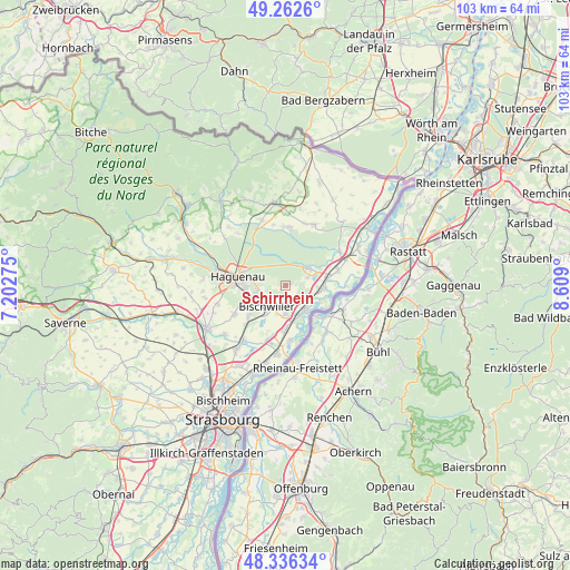
Schirrhein GPS coordinates[2]
48° 48' 5.796" North, 7° 54' 21.168" East
| Map corner | latitude | longitude |
|---|---|---|
| Upper-left | 49.2626°, | 7.20275° |
| Center: | 48.80161°, | 7.90588° |
| Lower-right: | 48.33634°, | 8.609° |
| Map W x H: | 103×103 km | = 64×64mi |
| max Lat: | 51.07786° ⇑24.4% North |
| Schirrhein: | 48.80161° |
| min Lat: | ⇓75.6% South 41.3874° |
| min Long | Schirrhein | max Long |
| -5.08615° | 7.90588° | 9.52242° |
| W 99.4%⇐ | ⇒0.59999999999999% E |
Elevation
Elevation of Schirrhein is 135 m = 443 ft, and this is 58.7 m = 193 ft below average elevation for this country.
| Max E: |
2333 m = 7654 ft | 49.2% |
| Avg. | 193.7 m = 635 ft | |
| Schirrhein | 135 m = 443 ft | |
Min E: |
-1 m = -3 ft | 50.8% |
See also: France elevation on elevation.city.
Geographical zone
Schirrhein is located in North temperate zone (between Tropic of Cancer and the Arctic Circle). Distance of this North polar circle is 1974.9 km =1227.1 mi to North.| Distance of | km | miles | from Schirrhein |
|---|---|---|---|
| North Pole | 4580.8 | 2846.4 | to North |
| Arctic Circle | 1974.9 | 1227.1 | to North |
| Tropic Cancer | 2820.3 | 1752.5 | to South |
| Equator | 5426.2 | 3371.7 | to South |


Nearby cities:
15 places around Schirrhein: (largest is in red/bold)
• Betschdorf
10.7 km =6.6 mi,  358°
358°
• Bischwiller
5.3 km =3.3 mi,  225°
225°
• Drusenheim
5.6 km =3.5 mi,  141°
141°
• Gries
8.6 km =5.3 mi, 231°
• Haguenau
8.6 km =5.3 mi,  280°
280°
• Herrlisheim
7.9 km =4.9 mi,  180°
180°
• Kaltenhouse
5.5 km =3.4 mi,  257°
257°
• Kurtzenhouse
10.1 km =6.3 mi, 227°
• Oberhoffen-sur-Moder
3.7 km =2.3 mi,  237°
237°
• Roeschwoog
10 km =6.2 mi,  73°
73°
• Roppenheim
11.7 km =7.3 mi, 67°
• Sessenheim
6 km =3.7 mi,  95°
95°
• Soufflenheim
5.2 km =3.2 mi,  52°
52°
• Weitbruch
10.6 km =6.6 mi, 240°
• Weyersheim
12.2 km =7.6 mi,  218°
218°
Sources, notices
• [Note1] Compared only with cities in France existing in our database
• [Src1] Map data: © OpenStreetMap contributors (CC-BY-SA)
• [Src2] Other city data from geonames.org with taken over terms of usage.
• [Src3] Geographical zone / Annual Mean Temperature by Robert A. Rohde @ Wikipedia
