Guillac geodata
Guillac (Brittany) is a populated place; located in France in Europe/Paris (GMT+2) time zone. With population of 1,170 people, there are 7711 cities with bigger population in this country. Compared to other cities in France, 57.7% of cities are located further ↓South; 96.2% of cities are located further →East and 77.3% of cities have higher elevation than Guillac. Note1
Administrative division(s):
- Level 1: Brittany
- Level 2: Morbihan
- Level 3: Arrondissement de Pontivy
- Level 4: Guillac


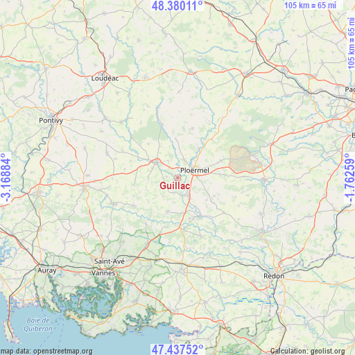
Guillac GPS coordinates[2]
47° 54' 39.456" North, 2° 27' 56.556" West
| Map corner | latitude | longitude |
|---|---|---|
| Upper-left | 48.38011°, | -3.16884° |
| Center: | 47.91096°, | -2.46571° |
| Lower-right: | 47.43752°, | -1.76259° |
| Map W x H: | 104.8×104.8 km | = 65.1×65.1mi |
| max Lat: | 51.07786° ⇑42.3% North |
| Guillac: | 47.91096° |
| min Lat: | ⇓57.7% South 41.3874° |
| min Long | Guillac | max Long |
| -5.08615° | -2.46571° | 9.52242° |
| W 3.8%⇐ | ⇒96.2% E |
Elevation
Elevation of Guillac is 61 m = 200 ft, and this is 132.7 m = 435 ft below average elevation for this country.
| Max E: |
2333 m = 7654 ft | 77.3% |
| Avg. | 193.7 m = 635 ft | |
| Guillac | 61 m = 200 ft | |
Min E: |
-1 m = -3 ft | 22.7% |
See also: France elevation on elevation.city.
Geographical zone
Guillac is located in North temperate zone (between Tropic of Cancer and the Arctic Circle). Distance of this North polar circle is 2074 km =1288.7 mi to North.| Distance of | km | miles | from Guillac |
|---|---|---|---|
| North Pole | 4679.9 | 2908 | to North |
| Arctic Circle | 2074 | 1288.7 | to North |
| Tropic Cancer | 2721.3 | 1690.9 | to South |
| Equator | 5327.2 | 3310.2 | to South |


Nearby cities:
15 places around Guillac: (largest is in red/bold)
• Caro
12.1 km =7.5 mi,  115°
115°
• Cruguel
10.3 km =6.4 mi,  249°
249°
• Guégon
7.9 km =4.9 mi,  291°
291°
• Josselin
8 km =5 mi,  310°
310°
• La Croix-Helléan
5.8 km =3.6 mi,  332°
332°
• Le Roc-Saint-André
5.4 km =3.4 mi,  166°
166°
• Lizio
7 km =4.3 mi,  220°
220°
• Loyat
10.7 km =6.6 mi,  35°
35°
• Missiriac
12 km =7.5 mi,  134°
134°
• Ploërmel
5.6 km =3.5 mi,  65°
65°
• Saint-Malo-des-Trois-Fontaines
11.5 km =7.1 mi,  357°
357°
• Saint-Marcel
12.4 km =7.7 mi,  163°
163°
• Saint-Servant
3.5 km =2.2 mi,  277°
277°
• Sérent
10.2 km =6.3 mi,  197°
197°
• Taupont
5.8 km =3.6 mi,  19°
19°
Sources, notices
• [Note1] Compared only with cities in France existing in our database
• [Src1] Map data: © OpenStreetMap contributors (CC-BY-SA)
• [Src2] Other city data from geonames.org with taken over terms of usage.
• [Src3] Geographical zone / Annual Mean Temperature by Robert A. Rohde @ Wikipedia
