Saint-Servant geodata
Saint-Servant (Brittany) is a populated place; located in France in Europe/Paris (GMT+2) time zone. With population of 796 people, there are 10658 cities with bigger population in this country. Compared to other cities in France, 57.8% of cities are located further ↓South; 96.2% of cities are located further →East and 70.1% of cities have higher elevation than Saint-Servant. Note1
Administrative division(s):
- Level 1: Brittany
- Level 2: Morbihan
- Level 3: Arrondissement de Pontivy
- Level 4: Saint-Servant


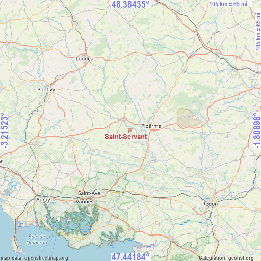
Saint-Servant GPS coordinates[2]
47° 54' 54.864" North, 2° 30' 43.56" West
| Map corner | latitude | longitude |
|---|---|---|
| Upper-left | 48.38435°, | -3.21523° |
| Center: | 47.91524°, | -2.5121° |
| Lower-right: | 47.44184°, | -1.80898° |
| Map W x H: | 104.8×104.8 km | = 65.1×65.1mi |
| max Lat: | 51.07786° ⇑42.2% North |
| Saint-Servant: | 47.91524° |
| min Lat: | ⇓57.8% South 41.3874° |
| min Long | Saint-Servant | max Long |
| -5.08615° | -2.5121° | 9.52242° |
| W 3.8%⇐ | ⇒96.2% E |
Elevation
Elevation of Saint-Servant is 78 m = 256 ft, and this is 115.7 m = 380 ft below average elevation for this country.
| Max E: |
2333 m = 7654 ft | 70.1% |
| Avg. | 193.7 m = 635 ft | |
| Saint-Servant | 78 m = 256 ft | |
Min E: |
-1 m = -3 ft | 29.9% |
See also: France elevation on elevation.city.
Geographical zone
Saint-Servant is located in North temperate zone (between Tropic of Cancer and the Arctic Circle). Distance of this North polar circle is 2073.5 km =1288.4 mi to North.| Distance of | km | miles | from Saint-Servant |
|---|---|---|---|
| North Pole | 4679.4 | 2907.6 | to North |
| Arctic Circle | 2073.5 | 1288.4 | to North |
| Tropic Cancer | 2721.8 | 1691.2 | to South |
| Equator | 5327.7 | 3310.5 | to South |


Nearby cities:
15 places around Saint-Servant: (largest is in red/bold)
• Cruguel
7.4 km =4.6 mi,  236°
236°
• Guillac
3.5 km =2.2 mi,  97°
97°
• Guégon
4.6 km =2.9 mi,  301°
301°
• Guéhenno
9.9 km =6.2 mi,  254°
254°
• Josselin
5.3 km =3.3 mi,  330°
330°
• La Croix-Helléan
4.7 km =2.9 mi,  10°
10°
• Lanouée
11 km =6.8 mi, 331°
• Le Roc-Saint-André
7.4 km =4.6 mi,  140°
140°
• Lizio
5.9 km =3.7 mi,  189°
189°
• Loyat
12.6 km =7.8 mi,  49°
49°
• Ploërmel
8.7 km =5.4 mi,  77°
77°
• Plumelec
12.9 km =8 mi,  227°
227°
• Saint-Malo-des-Trois-Fontaines
11.4 km =7.1 mi, 14°
• Sérent
10.2 km =6.3 mi,  177°
177°
• Taupont
7.3 km =4.5 mi, 47°
Sources, notices
• [Note1] Compared only with cities in France existing in our database
• [Src1] Map data: © OpenStreetMap contributors (CC-BY-SA)
• [Src2] Other city data from geonames.org with taken over terms of usage.
• [Src3] Geographical zone / Annual Mean Temperature by Robert A. Rohde @ Wikipedia
