Saint-Malo-des-Trois-Fontaines geodata
Saint-Malo-des-Trois-Fontaines (Brittany) is a populated place; located in France in Europe/Paris (GMT+2) time zone. With population of 529 people, there are 14624 cities with bigger population in this country. Compared to other cities in France, 59.5% of cities are located further ↓South; 96.2% of cities are located further →East and 73.6% of cities have higher elevation than Saint-Malo-des-Trois-Fontaines. Note1
Administrative division(s):
- Level 1: Brittany
- Level 2: Morbihan
- Level 3: Arrondissement de Pontivy
- Level 4: Saint-Malo-des-Trois-Fontaines
Current local time in Saint-Malo-des-Trois-Fontaines:
12:29 PM, MondayDifference from your time zone: hours


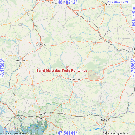
Saint-Malo-des-Trois-Fontaines GPS coordinates[2]
48° 0' 50.076" North, 2° 28' 21.936" West
| Map corner | latitude | longitude |
|---|---|---|
| Upper-left | 48.48212°, | -3.17588° |
| Center: | 48.01391°, | -2.47276° |
| Lower-right: | 47.54141°, | -1.76963° |
| Map W x H: | 104.6×104.6 km | = 65×65mi |
| max Lat: | 51.07786° ⇑40.5% North |
| Saint-Malo-des-Trois-Fontaines: | 48.01391° |
| min Lat: | ⇓59.5% South 41.3874° |
| min Long | Saint-Malo-des- | max Long |
| -5.08615° | -2.47276° | 9.52242° |
| W 3.8%⇐ | ⇒96.2% E |
Elevation
Elevation of Saint-Malo-des-Trois-Fontaines is 70 m = 230 ft, and this is 123.7 m = 406 ft below average elevation for this country.
| Max E: |
2333 m = 7654 ft | 73.6% |
| Avg. | 193.7 m = 635 ft | |
| Saint-Malo-des-Trois-Fontaines | 70 m = 230 ft | |
Min E: |
-1 m = -3 ft | 26.4% |
See also: France elevation on elevation.city.
Geographical zone
Saint-Malo-des-Trois-Fontaines is located in North temperate zone (between Tropic of Cancer and the Arctic Circle). Distance of this North polar circle is 2062.5 km =1281.6 mi to North.| Distance of | km | miles | from Saint-Malo-des-Trois-Fontaines |
|---|---|---|---|
| North Pole | 4668.4 | 2900.8 | to North |
| Arctic Circle | 2062.5 | 1281.6 | to North |
| Tropic Cancer | 2732.7 | 1698 | to South |
| Equator | 5338.6 | 3317.3 | to South |


Nearby cities:
15 places around Saint-Malo-des-Trois-Fontaines: (largest is in red/bold)
• Guillac
11.5 km =7.1 mi,  177°
177°
• Guilliers
5.9 km =3.7 mi,  57°
57°
• Guégon
10.9 km =6.8 mi,  218°
218°
• Josselin
8.4 km =5.2 mi, 221°
• La Croix-Helléan
6.7 km =4.2 mi,  198°
198°
• La Trinité-Porhoët
10.7 km =6.6 mi,  330°
330°
• Lanouée
8.2 km =5.1 mi,  260°
260°
• Le Cambout
11.4 km =7.1 mi,  296°
296°
• Loyat
7.2 km =4.5 mi,  112°
112°
• Mohon
5.8 km =3.6 mi,  317°
317°
• Néant-sur-Yvel
10.7 km =6.6 mi,  90°
90°
• Ploërmel
10.7 km =6.6 mi,  148°
148°
• Plumieux
12.9 km =8 mi, 320°
• Saint-Servant
11.4 km =7.1 mi,  194°
194°
• Taupont
6.5 km =4 mi,  157°
157°
Sources, notices
• [Note1] Compared only with cities in France existing in our database
• [Src1] Map data: © OpenStreetMap contributors (CC-BY-SA)
• [Src2] Other city data from geonames.org with taken over terms of usage.
• [Src3] Geographical zone / Annual Mean Temperature by Robert A. Rohde @ Wikipedia
