Grand geodata
Grand (Grand Est) is a populated place; located in France in Europe/Paris (GMT+2) time zone. With population of 518 people, there are 14866 cities with bigger population in this country. Compared to other cities in France, 66.1% of cities are located further ↓South; 82.8% of cities are located further ←West and 87.1% of cities have lower elevation than Grand. Note1
Administrative division(s):
- Level 1: Grand Est
- Level 2: Vosges
- Level 3: Arrondissement de Neufchâteau
- Level 4: Grand


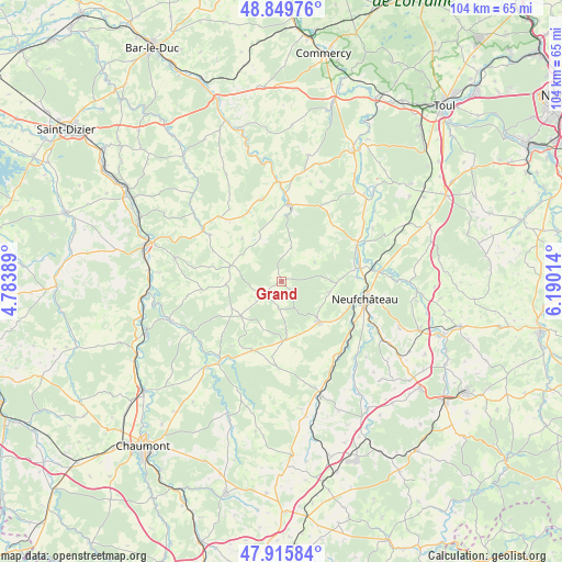
Grand GPS coordinates[2]
48° 23' 5.784" North, 5° 29' 13.236" East
| Map corner | latitude | longitude |
|---|---|---|
| Upper-left | 48.84976°, | 4.78389° |
| Center: | 48.38494°, | 5.48701° |
| Lower-right: | 47.91584°, | 6.19014° |
| Map W x H: | 103.8×103.8 km | = 64.5×64.5mi |
| max Lat: | 51.07786° ⇑33.9% North |
| Grand: | 48.38494° |
| min Lat: | ⇓66.1% South 41.3874° |
| min Long | Grand | max Long |
| -5.08615° | 5.48701° | 9.52242° |
| W 82.8%⇐ | ⇒17.2% E |
Elevation
Elevation of Grand is 376 m = 1234 ft, and this is 182.3 m = 598 ft above average elevation for this country.
| Max E: |
2333 m = 7654 ft | 12.9% |
| Grand | 376 m 1234 ft | |
| Avg. | 193.7 m = 635 ft | |
Min E: |
-1 m = -3 ft | 87.1% |
See also: France elevation on elevation.city.
Geographical zone
Grand is located in North temperate zone (between Tropic of Cancer and the Arctic Circle). Distance of this North polar circle is 2021.3 km =1256 mi to North.| Distance of | km | miles | from Grand |
|---|---|---|---|
| North Pole | 4627.2 | 2875.2 | to North |
| Arctic Circle | 2021.3 | 1256 | to North |
| Tropic Cancer | 2774 | 1723.7 | to South |
| Equator | 5379.9 | 3342.9 | to South |


Nearby cities:
15 places around Grand: (largest is in red/bold)
• Andelot-Blancheville
20.4 km =12.7 mi,  222°
222°
• Bazoilles-sur-Meuse
15.5 km =9.6 mi,  125°
125°
• Bettaincourt-sur-Rognon
19.4 km =12.1 mi,  242°
242°
• Bourmont
22.6 km =14 mi,  160°
160°
• Coussey
14.8 km =9.2 mi,  80°
80°
• Demange-aux-Eaux
22 km =13.7 mi,  354°
354°
• Doulaincourt-Saucourt
22.5 km =14 mi,  250°
250°
• Gondrecourt-le-Château
14.4 km =8.9 mi,  6°
6°
• Liffol-le-Grand
10.2 km =6.3 mi,  137°
137°
• Neufchâteau
15.8 km =9.8 mi,  101°
101°
• Rimaucourt
18.6 km =11.6 mi, 217°
• Saint-Urbain-Maconcourt
22.5 km =14 mi,  274°
274°
• Soulosse-sous-Saint-Élophe
18.3 km =11.4 mi, 84°
• Thonnance-lès-Joinville
24.4 km =15.2 mi,  288°
288°
• Tréveray
26 km =16.2 mi, 345°
Sources, notices
• [Note1] Compared only with cities in France existing in our database
• [Src1] Map data: © OpenStreetMap contributors (CC-BY-SA)
• [Src2] Other city data from geonames.org with taken over terms of usage.
• [Src3] Geographical zone / Annual Mean Temperature by Robert A. Rohde @ Wikipedia
