Tréveray geodata
Tréveray (Grand Est) is a populated place; located in France in Europe/Paris (GMT+2) time zone. With population of 750 people, there are 11167 cities with bigger population in this country. Compared to other cities in France, 71.1% of cities are located further ↓South; 81.9% of cities are located further ←West and 76.2% of cities have lower elevation than Tréveray. Note1
Administrative division(s):
- Level 1: Grand Est
- Level 2: Meuse
- Level 3: Arrondissement de Commercy
- Level 4: Tréveray


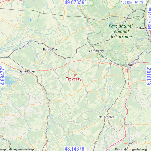
Tréveray GPS coordinates[2]
48° 36' 38.916" North, 5° 23' 52.44" East
| Map corner | latitude | longitude |
|---|---|---|
| Upper-left | 49.07356°, | 4.69477° |
| Center: | 48.61081°, | 5.3979° |
| Lower-right: | 48.14378°, | 6.10102° |
| Map W x H: | 103.4×103.4 km | = 64.2×64.2mi |
| max Lat: | 51.07786° ⇑28.9% North |
| Tréveray: | 48.61081° |
| min Lat: | ⇓71.1% South 41.3874° |
| min Long | Tréveray | max Long |
| -5.08615° | 5.3979° | 9.52242° |
| W 81.9%⇐ | ⇒18.1% E |
Elevation
Elevation of Tréveray is 258 m = 846 ft, and this is 64.3 m = 211 ft above average elevation for this country.
| Max E: |
2333 m = 7654 ft | 23.8% |
| Tréveray | 258 m 846 ft | |
| Avg. | 193.7 m = 635 ft | |
Min E: |
-1 m = -3 ft | 76.2% |
See also: France elevation on elevation.city.
Geographical zone
Tréveray is located in North temperate zone (between Tropic of Cancer and the Arctic Circle). Distance of this North polar circle is 1996.2 km =1240.4 mi to North.| Distance of | km | miles | from Tréveray |
|---|---|---|---|
| North Pole | 4602 | 2859.5 | to North |
| Arctic Circle | 1996.2 | 1240.4 | to North |
| Tropic Cancer | 2799.1 | 1739.3 | to South |
| Equator | 5405 | 3358.5 | to South |


Nearby cities:
15 places around Tréveray: (largest is in red/bold)
• Chevillon
21.7 km =13.5 mi,  245°
245°
• Commercy
21.9 km =13.6 mi,  40°
40°
• Demange-aux-Eaux
5.6 km =3.5 mi,  125°
125°
• Euville
22.8 km =14.2 mi,  47°
47°
• Gondrecourt-le-Château
13.6 km =8.5 mi,  142°
142°
• Ligny-en-Barrois
10.2 km =6.3 mi,  328°
328°
• Longeville-en-Barrois
20.2 km =12.6 mi,  316°
316°
• Lérouville
22.8 km =14.2 mi,  27°
27°
• Savonnières-devant-Bar
23 km =14.3 mi, 315°
• Sorcy-Saint-Martin
20.8 km =12.9 mi,  56°
56°
• Tronville-en-Barrois
15 km =9.3 mi, 324°
• Vacon
16.2 km =10.1 mi,  66°
66°
• Vaucouleurs
19.8 km =12.3 mi,  92°
92°
• Velaines
11.9 km =7.4 mi, 325°
• Void-Vacon
18 km =11.2 mi, 63°
Sources, notices
• [Note1] Compared only with cities in France existing in our database
• [Src1] Map data: © OpenStreetMap contributors (CC-BY-SA)
• [Src2] Other city data from geonames.org with taken over terms of usage.
• [Src3] Geographical zone / Annual Mean Temperature by Robert A. Rohde @ Wikipedia
