Soulosse-sous-Saint-Élophe geodata
Soulosse-sous-Saint-Élophe (Grand Est) is a populated place; located in France in Europe/Paris (GMT+2) time zone. With population of 566 people, there are 13895 cities with bigger population in this country. Compared to other cities in France, 66.3% of cities are located further ↓South; 84.6% of cities are located further ←West and 79.2% of cities have lower elevation than Soulosse-sous-Saint-Élophe. Note1
Administrative division(s):
- Level 1: Grand Est
- Level 2: Vosges
- Level 3: Arrondissement de Neufchâteau
- Level 4: Soulosse-sous-Saint-Élophe
Current local time in Soulosse-sous-Saint-Élophe:
04:10 AM, SaturdayDifference from your time zone: hours


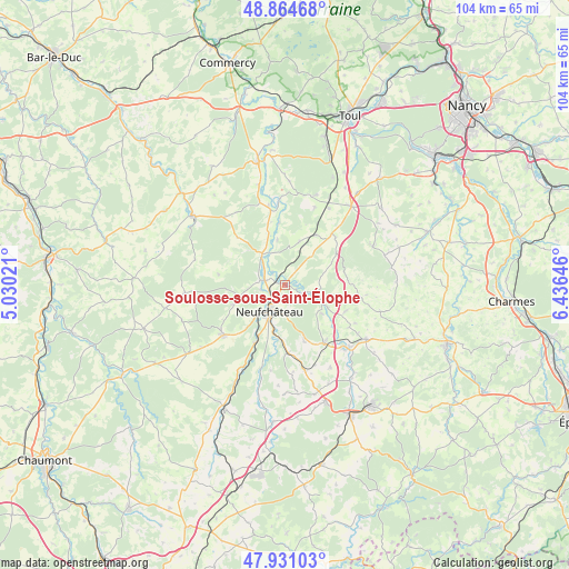
Soulosse-sous-Saint-Élophe GPS coordinates[2]
48° 24' 0" North, 5° 43' 59.988" East
| Map corner | latitude | longitude |
|---|---|---|
| Upper-left | 48.86468°, | 5.03021° |
| Center: | 48.4°, | 5.73333° |
| Lower-right: | 47.93103°, | 6.43646° |
| Map W x H: | 103.8×103.8 km | = 64.5×64.5mi |
| max Lat: | 51.07786° ⇑33.7% North |
| Soulosse-sous-Saint-Élophe: | 48.4° |
| min Lat: | ⇓66.3% South 41.3874° |
| min Long | Soulosse-sous-S | max Long |
| -5.08615° | 5.73333° | 9.52242° |
| W 84.6%⇐ | ⇒15.4% E |
Elevation
Elevation of Soulosse-sous-Saint-Élophe is 282 m = 925 ft, and this is 88.3 m = 290 ft above average elevation for this country.
| Max E: |
2333 m = 7654 ft | 20.8% |
| Soulosse-sous-Saint-Élophe | 282 m 925 ft | |
| Avg. | 193.7 m = 635 ft | |
Min E: |
-1 m = -3 ft | 79.2% |
See also: France elevation on elevation.city.
Geographical zone
Soulosse-sous-Saint-Élophe is located in North temperate zone (between Tropic of Cancer and the Arctic Circle). Distance of this North polar circle is 2019.6 km =1254.9 mi to North.| Distance of | km | miles | from Soulosse-sous-Saint-Élophe |
|---|---|---|---|
| North Pole | 4625.5 | 2874.2 | to North |
| Arctic Circle | 2019.6 | 1254.9 | to North |
| Tropic Cancer | 2775.7 | 1724.7 | to South |
| Equator | 5381.6 | 3344 | to South |


Nearby cities:
15 places around Soulosse-sous-Saint-Élophe: (largest is in red/bold)
• Allamps
17.3 km =10.7 mi,  18°
18°
• Bazoilles-sur-Meuse
12 km =7.5 mi,  207°
207°
• Blénod-lès-Toul
23.4 km =14.5 mi, 19°
• Bulgnéville
22.7 km =14.1 mi,  160°
160°
• Châtenois
13 km =8.1 mi,  146°
146°
• Colombey-les-Belles
18.6 km =11.6 mi,  39°
39°
• Coussey
3.7 km =2.3 mi,  282°
282°
• Favières
17.8 km =11.1 mi,  66°
66°
• Gironcourt-sur-Vraine
17.8 km =11.1 mi,  123°
123°
• Gondrecourt-le-Château
20.7 km =12.9 mi,  307°
307°
• Grand
18.3 km =11.4 mi,  264°
264°
• Liffol-le-Grand
14.5 km =9 mi,  230°
230°
• Neufchâteau
5.7 km =3.5 mi, 209°
• Vannes-le-Châtel
16.7 km =10.4 mi,  12°
12°
• Vaucouleurs
23.1 km =14.4 mi,  347°
347°
Sources, notices
• [Note1] Compared only with cities in France existing in our database
• [Src1] Map data: © OpenStreetMap contributors (CC-BY-SA)
• [Src2] Other city data from geonames.org with taken over terms of usage.
• [Src3] Geographical zone / Annual Mean Temperature by Robert A. Rohde @ Wikipedia
