Seuil-d'Argonne geodata
Seuil-d'Argonne (Grand Est) is a populated place; located in France in Europe/Paris (GMT+2) time zone. With population of 503 people, there are 15179 cities with bigger population in this country. Compared to other cities in France, 79.2% of cities are located further ↓South; 78.3% of cities are located further ←West and 61.6% of cities have lower elevation than Seuil-d'Argonne. Note1
Administrative division(s):
- Level 1: Grand Est
- Level 2: Meuse
- Level 3: Arrondissement de Bar-le-Duc
- Level 4: Seuil-d'Argonne


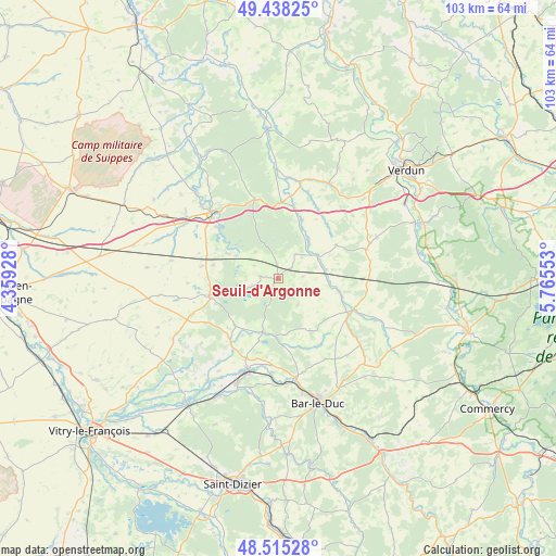
Seuil-d'Argonne GPS coordinates[2]
48° 58' 44.04" North, 5° 3' 44.64" East
| Map corner | latitude | longitude |
|---|---|---|
| Upper-left | 49.43825°, | 4.35928° |
| Center: | 48.9789°, | 5.0624° |
| Lower-right: | 48.51528°, | 5.76553° |
| Map W x H: | 102.6×102.6 km | = 63.8×63.8mi |
| max Lat: | 51.07786° ⇑20.8% North |
| Seuil-d'Argonne: | 48.9789° |
| min Lat: | ⇓79.2% South 41.3874° |
| min Long | Seuil-d'Argonne | max Long |
| -5.08615° | 5.0624° | 9.52242° |
| W 78.3%⇐ | ⇒21.7% E |
Elevation
Elevation of Seuil-d'Argonne is 178 m = 584 ft, and this is 15.7 m = 52 ft below average elevation for this country.
| Max E: |
2333 m = 7654 ft | 38.4% |
| Avg. | 193.7 m = 635 ft | |
| Seuil-d'Argonne | 178 m = 584 ft | |
Min E: |
-1 m = -3 ft | 61.6% |
See also: France elevation on elevation.city.
Geographical zone
Seuil-d'Argonne is located in North temperate zone (between Tropic of Cancer and the Arctic Circle). Distance of this North polar circle is 1955.2 km =1214.9 mi to North.| Distance of | km | miles | from Seuil-d'Argonne |
|---|---|---|---|
| North Pole | 4561.1 | 2834.1 | to North |
| Arctic Circle | 1955.2 | 1214.9 | to North |
| Tropic Cancer | 2840 | 1764.7 | to South |
| Equator | 5445.9 | 3383.9 | to South |


Nearby cities:
15 places around Seuil-d'Argonne: (largest is in red/bold)
• Bar-le-Duc
24 km =14.9 mi,  162°
162°
• Behonne
22.4 km =13.9 mi, 156°
• Beurey-sur-Saulx
24.8 km =15.4 mi,  186°
186°
• Clermont-en-Argonne
14.3 km =8.9 mi,  2°
2°
• Combles-en-Barrois
25.6 km =15.9 mi,  171°
171°
• Contrisson
21 km =13 mi,  201°
201°
• Fains-Véel
22.4 km =13.9 mi, 166°
• Givry-en-Argonne
13.2 km =8.2 mi,  255°
255°
• Les Islettes
15.1 km =9.4 mi,  343°
343°
• Naives-Rosières
24.5 km =15.2 mi,  152°
152°
• Revigny-sur-Ornain
17.5 km =10.9 mi, 198°
• Sainte-Menehould
17.3 km =10.7 mi,  315°
315°
• Savonnières-devant-Bar
26 km =16.2 mi, 161°
• Sermaize-les-Bains
24.2 km =15 mi,  207°
207°
• Trémont-sur-Saulx
25.6 km =15.9 mi,  180°
180°
Sources, notices
• [Note1] Compared only with cities in France existing in our database
• [Src1] Map data: © OpenStreetMap contributors (CC-BY-SA)
• [Src2] Other city data from geonames.org with taken over terms of usage.
• [Src3] Geographical zone / Annual Mean Temperature by Robert A. Rohde @ Wikipedia
