Ginasservis geodata
Ginasservis (Provence-Alpes-Côte d'Azur) is a populated place; located in France in Europe/Paris (GMT+2) time zone. With population of 1,067 people, there are 8359 cities with bigger population in this country. Compared to other cities in France, 90.9% of cities are located further ↑North; 85.5% of cities are located further ←West and 89.8% of cities have lower elevation than Ginasservis. Note1
Administrative division(s):
- Level 1: Provence-Alpes-Côte d'Azur
- Level 2: Var
- Level 3: Arrondissement de Brignoles
- Level 4: Ginasservis


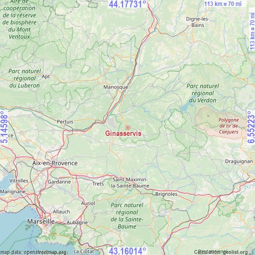
Ginasservis GPS coordinates[2]
43° 40' 15.168" North, 5° 50' 56.796" East
| Map corner | latitude | longitude |
|---|---|---|
| Upper-left | 44.17731°, | 5.14598° |
| Center: | 43.67088°, | 5.84911° |
| Lower-right: | 43.16014°, | 6.55223° |
| Map W x H: | 113.1×113.1 km | = 70.3×70.3mi |
| max Lat: | 51.07786° ⇑90.9% North |
| Ginasservis: | 43.67088° |
| min Lat: | ⇓9.1% South 41.3874° |
| min Long | Ginasservis | max Long |
| -5.08615° | 5.84911° | 9.52242° |
| W 85.5%⇐ | ⇒14.5% E |
Elevation
Elevation of Ginasservis is 423 m = 1388 ft, and this is 229.3 m = 752 ft above average elevation for this country.
| Max E: |
2333 m = 7654 ft | 10.2% |
| Ginasservis | 423 m 1388 ft | |
| Avg. | 193.7 m = 635 ft | |
Min E: |
-1 m = -3 ft | 89.8% |
See also: France elevation on elevation.city.
Geographical zone
Ginasservis is located in North temperate zone (between Tropic of Cancer and the Arctic Circle). Distance of this Northern Tropic circle is 2249.8 km =1398 mi to South.| Distance of | km | miles | from Ginasservis |
|---|---|---|---|
| North Pole | 5151.3 | 3200.9 | to North |
| Arctic Circle | 2545.4 | 1581.6 | to North |
| Tropic Cancer | 2249.8 | 1398 | to South |
| Equator | 4855.7 | 3017.2 | to South |


Nearby cities:
15 places around Ginasservis: (largest is in red/bold)
• Beaumont-de-Pertuis
14.8 km =9.2 mi,  299°
299°
• Brue-Auriac
17.5 km =10.9 mi,  154°
154°
• Corbières-en-Provence
12.7 km =7.9 mi,  321°
321°
• Gréoux-les-Bains
10.1 km =6.3 mi,  15°
15°
• Jouques
17.5 km =10.9 mi,  257°
257°
• La Verdière
7.7 km =4.8 mi,  117°
117°
• Mirabeau
16 km =9.9 mi,  283°
283°
• Pierrevert
17.5 km =10.9 mi,  332°
332°
• Rians
10.3 km =6.4 mi,  226°
226°
• Saint-Julien
5.2 km =3.2 mi,  64°
64°
• Saint-Paul-lès-Durance
11.5 km =7.1 mi, 277°
• Sainte-Tulle
14.5 km =9 mi, 332°
• Tavernes
16 km =9.9 mi, 122°
• Varages
12.1 km =7.5 mi,  132°
132°
• Vinon-sur-Verdon
6.7 km =4.2 mi, 333°
Sources, notices
• [Note1] Compared only with cities in France existing in our database
• [Src1] Map data: © OpenStreetMap contributors (CC-BY-SA)
• [Src2] Other city data from geonames.org with taken over terms of usage.
• [Src3] Geographical zone / Annual Mean Temperature by Robert A. Rohde @ Wikipedia
