Jouques geodata
Jouques (Provence-Alpes-Côte d'Azur) is a populated place; located in France in Europe/Paris (GMT+2) time zone. With population of 3,500 people, there are 2780 cities with bigger population in this country. Compared to other cities in France, 91.4% of cities are located further ↑North; 84% of cities are located further ←West and 81.9% of cities have lower elevation than Jouques. Note1
Administrative division(s):
- Level 1: Provence-Alpes-Côte d'Azur
- Level 2: Département des Bouches-du-Rhône
- Level 3: Aix-en-Provence
- Level 4: Jouques


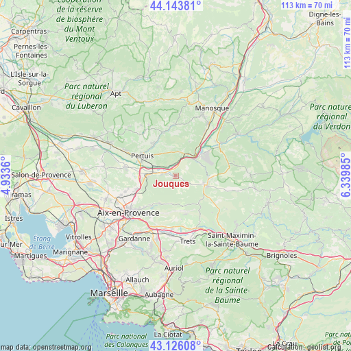
Jouques GPS coordinates[2]
43° 38' 13.56" North, 5° 38' 12.192" East
| Map corner | latitude | longitude |
|---|---|---|
| Upper-left | 44.14381°, | 4.9336° |
| Center: | 43.6371°, | 5.63672° |
| Lower-right: | 43.12608°, | 6.33985° |
| Map W x H: | 113.2×113.2 km | = 70.3×70.3mi |
| max Lat: | 51.07786° ⇑91.4% North |
| Jouques: | 43.6371° |
| min Lat: | ⇓8.6% South 41.3874° |
| min Long | Jouques | max Long |
| -5.08615° | 5.63672° | 9.52242° |
| W 84%⇐ | ⇒16% E |
Elevation
Elevation of Jouques is 310 m = 1017 ft, and this is 116.3 m = 382 ft above average elevation for this country.
| Max E: |
2333 m = 7654 ft | 18.1% |
| Jouques | 310 m 1017 ft | |
| Avg. | 193.7 m = 635 ft | |
Min E: |
-1 m = -3 ft | 81.9% |
See also: France elevation on elevation.city.
Geographical zone
Jouques is located in North temperate zone (between Tropic of Cancer and the Arctic Circle). Distance of this Northern Tropic circle is 2246.1 km =1395.7 mi to South.| Distance of | km | miles | from Jouques |
|---|---|---|---|
| North Pole | 5155.1 | 3203.2 | to North |
| Arctic Circle | 2549.2 | 1584 | to North |
| Tropic Cancer | 2246.1 | 1395.7 | to South |
| Equator | 4852 | 3014.9 | to South |


Nearby cities:
15 places around Jouques: (largest is in red/bold)
• Beaumont-de-Pertuis
11.9 km =7.4 mi,  20°
20°
• Beaurecueil
15.7 km =9.8 mi,  207°
207°
• Grambois
14.5 km =9 mi,  344°
344°
• La Bastidonne
9 km =5.6 mi,  321°
321°
• Le Tholonet
16.3 km =10.1 mi,  218°
218°
• Meyrargues
8.8 km =5.5 mi,  269°
269°
• Mirabeau
7.6 km =4.7 mi,  11°
11°
• Pertuis
12.5 km =7.8 mi,  300°
300°
• Peyrolles-en-Provence
4.3 km =2.7 mi,  282°
282°
• Puyloubier
12.8 km =8 mi,  165°
165°
• Rians
10.2 km =6.3 mi,  109°
109°
• Saint-Marc-Jaumegarde
13.6 km =8.5 mi, 222°
• Saint-Paul-lès-Durance
7.8 km =4.8 mi,  46°
46°
• Vauvenargues
9.6 km =6 mi,  198°
198°
• Venelles
13.3 km =8.3 mi,  251°
251°
Sources, notices
• [Note1] Compared only with cities in France existing in our database
• [Src1] Map data: © OpenStreetMap contributors (CC-BY-SA)
• [Src2] Other city data from geonames.org with taken over terms of usage.
• [Src3] Geographical zone / Annual Mean Temperature by Robert A. Rohde @ Wikipedia
