Gennevilliers geodata
Gennevilliers (Île-de-France) is a populated place; located in France in Europe/Paris (GMT+2) time zone. With population of 42,294 people, there are 169 cities with bigger population in this country. Compared to other cities in France, 78.2% of cities are located further ↓South; 52.7% of cities are located further →East and 89.5% of cities have higher elevation than Gennevilliers. Note1
Administrative division(s):
- Level 1: Île-de-France
- Level 2: Hauts-de-Seine
- Level 3: Arrondissement de Nanterre
- Level 4: Gennevilliers


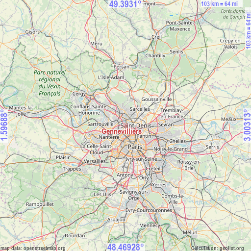
Gennevilliers GPS coordinates[2]
48° 55' 59.988" North, 2° 18' 0" East
| Map corner | latitude | longitude |
|---|---|---|
| Upper-left | 49.3931°, | 1.59688° |
| Center: | 48.93333°, | 2.3° |
| Lower-right: | 48.46928°, | 3.00313° |
| Map W x H: | 102.7×102.7 km | = 63.8×63.8mi |
| max Lat: | 51.07786° ⇑21.8% North |
| Gennevilliers: | 48.93333° |
| min Lat: | ⇓78.2% South 41.3874° |
| min Long | Gennevilliers | max Long |
| -5.08615° | 2.3° | 9.52242° |
| W 47.3%⇐ | ⇒52.7% E |
Elevation
Elevation of Gennevilliers is 31 m = 102 ft, and this is 162.7 m = 534 ft below average elevation for this country.
| Max E: |
2333 m = 7654 ft | 89.5% |
| Avg. | 193.7 m = 635 ft | |
| Gennevilliers | 31 m = 102 ft | |
Min E: |
-1 m = -3 ft | 10.5% |
See also: Gennevilliers elevation on elevation.city.
Geographical zone
Gennevilliers is located in North temperate zone (between Tropic of Cancer and the Arctic Circle). Distance of this North polar circle is 1960.3 km =1218.1 mi to North.| Distance of | km | miles | from Gennevilliers |
|---|---|---|---|
| North Pole | 4566.2 | 2837.3 | to North |
| Arctic Circle | 1960.3 | 1218.1 | to North |
| Tropic Cancer | 2835 | 1761.6 | to South |
| Equator | 5440.9 | 3380.8 | to South |


Nearby cities:
15 places around Gennevilliers: (largest is in red/bold)
• Argenteuil
4.2 km =2.6 mi,  292°
292°
• Asnières-sur-Seine
2.2 km =1.4 mi,  213°
213°
• Bois-Colombes
2.4 km =1.5 mi,  229°
229°
• Clichy
3.8 km =2.4 mi,  169°
169°
• Colombes
3.7 km =2.3 mi,  244°
244°
• Deuil-la-Barre
5.2 km =3.2 mi,  22°
22°
• Enghien-les-Bains
3.9 km =2.4 mi, 18°
• La Garenne-Colombes
5 km =3.1 mi, 230°
• Levallois-Perret
4.5 km =2.8 mi,  190°
190°
• Saint-Denis
3.9 km =2.4 mi,  86°
86°
• Saint-Gratien
4.6 km =2.9 mi,  348°
348°
• Saint-Ouen
3.9 km =2.4 mi,  140°
140°
• Villeneuve-la-Garenne
1.3 km =0.8 mi,  58°
58°
• Villetaneuse
4.1 km =2.5 mi,  47°
47°
• Épinay-sur-Seine
2.5 km =1.6 mi,  26°
26°
Sources, notices
• [Note1] Compared only with cities in France existing in our database
• [Src1] Map data: © OpenStreetMap contributors (CC-BY-SA)
• [Src2] Other city data from geonames.org with taken over terms of usage.
• [Src3] Geographical zone / Annual Mean Temperature by Robert A. Rohde @ Wikipedia
