Épinay-sur-Seine geodata
Épinay-sur-Seine (Île-de-France) is a populated place; located in France in Europe/Paris (GMT+2) time zone. With population of 46,145 people, there are 143 cities with bigger population in this country. Compared to other cities in France, 78.6% of cities are located further ↓South; 52.5% of cities are located further →East and 87.1% of cities have higher elevation than Épinay-sur-Seine. Note1
Administrative division(s):
- Level 1: Île-de-France
- Level 2: Seine-Saint-Denis
- Level 3: Arrondissement de Saint-Denis
- Level 4: Épinay-sur-Seine


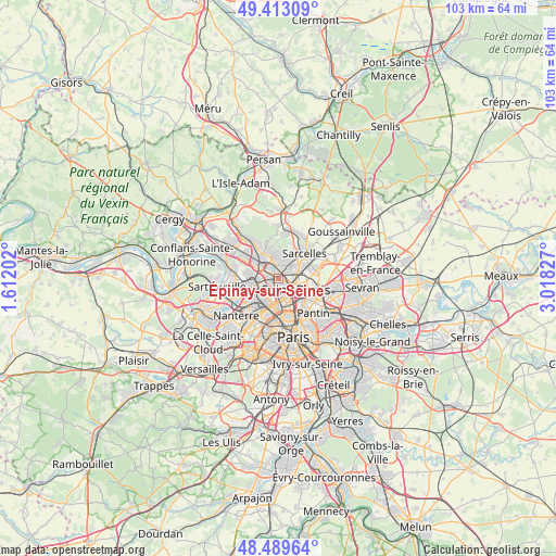
Épinay-sur-Seine GPS coordinates[2]
48° 57' 12.6" North, 2° 18' 54.504" East
| Map corner | latitude | longitude |
|---|---|---|
| Upper-left | 49.41309°, | 1.61202° |
| Center: | 48.9535°, | 2.31514° |
| Lower-right: | 48.48964°, | 3.01827° |
| Map W x H: | 102.7×102.7 km | = 63.8×63.8mi |
| max Lat: | 51.07786° ⇑21.4% North |
| Épinay-sur-Seine: | 48.9535° |
| min Lat: | ⇓78.6% South 41.3874° |
| min Long | Épinay-sur-Sei | max Long |
| -5.08615° | 2.31514° | 9.52242° |
| W 47.5%⇐ | ⇒52.5% E |
Elevation
Elevation of Épinay-sur-Seine is 37 m = 121 ft, and this is 156.7 m = 514 ft below average elevation for this country.
| Max E: |
2333 m = 7654 ft | 87.1% |
| Avg. | 193.7 m = 635 ft | |
| Épinay-sur-Seine | 37 m = 121 ft | |
Min E: |
-1 m = -3 ft | 12.9% |
See also: Épinay-sur-Seine elevation on elevation.city.
Geographical zone
Épinay-sur-Seine is located in North temperate zone (between Tropic of Cancer and the Arctic Circle). Distance of this North polar circle is 1958.1 km =1216.7 mi to North.| Distance of | km | miles | from Épinay-sur-Seine |
|---|---|---|---|
| North Pole | 4563.9 | 2835.9 | to North |
| Arctic Circle | 1958.1 | 1216.7 | to North |
| Tropic Cancer | 2837.2 | 1763 | to South |
| Equator | 5443.1 | 3382.2 | to South |


Nearby cities:
15 places around Épinay-sur-Seine: (largest is in red/bold)
• Asnières-sur-Seine
4.7 km =2.9 mi,  209°
209°
• Bois-Colombes
4.8 km =3 mi,  217°
217°
• Deuil-la-Barre
2.7 km =1.7 mi,  18°
18°
• Enghien-les-Bains
1.5 km =0.9 mi,  4°
4°
• Gennevilliers
2.5 km =1.6 mi, 206°
• Groslay
4.3 km =2.7 mi,  33°
33°
• Montmagny
3.2 km =2 mi,  46°
46°
• Montmorency
4.4 km =2.7 mi, 28°
• Pierrefitte-sur-Seine
3.7 km =2.3 mi,  66°
66°
• Saint-Denis
3.5 km =2.2 mi,  125°
125°
• Saint-Gratien
3 km =1.9 mi,  317°
317°
• Soisy-sous-Montmorency
4 km =2.5 mi,  345°
345°
• Stains
5 km =3.1 mi,  94°
94°
• Villeneuve-la-Garenne
1.6 km =1 mi,  180°
180°
• Villetaneuse
2 km =1.2 mi, 74°
Sources, notices
• [Note1] Compared only with cities in France existing in our database
• [Src1] Map data: © OpenStreetMap contributors (CC-BY-SA)
• [Src2] Other city data from geonames.org with taken over terms of usage.
• [Src3] Geographical zone / Annual Mean Temperature by Robert A. Rohde @ Wikipedia
