Saint-Sauves-d'Auvergne geodata
Saint-Sauves-d'Auvergne (Auvergne-Rhône-Alpes) is a populated place; located in France in Europe/Paris (GMT+2) time zone. With population of 1,104 people, there are 8107 cities with bigger population in this country. Compared to other cities in France, 72.6% of cities are located further ↑North; 53.2% of cities are located further ←West and 98.5% of cities have lower elevation than Saint-Sauves-d'Auvergne. Note1
Administrative division(s):
- Level 1: Auvergne-Rhône-Alpes
- Level 2: Département du Puy-de-Dôme
- Level 3: Issoire
- Level 4: Saint-Sauves-d'Auvergne
Current local time in Saint-Sauves-d'Auvergne:
09:57 AM, SaturdayDifference from your time zone: hours


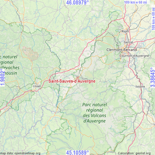
Saint-Sauves-d'Auvergne GPS coordinates[2]
45° 36' 0" North, 2° 40' 59.988" East
| Map corner | latitude | longitude |
|---|---|---|
| Upper-left | 46.08979°, | 1.9802° |
| Center: | 45.6°, | 2.68333° |
| Lower-right: | 45.10589°, | 3.38645° |
| Map W x H: | 109.4×109.4 km | = 68×68mi |
| max Lat: | 51.07786° ⇑72.6% North |
| Saint-Sauves-d'Auvergne: | 45.6° |
| min Lat: | ⇓27.4% South 41.3874° |
| min Long | Saint-Sauves-d' | max Long |
| -5.08615° | 2.68333° | 9.52242° |
| W 53.2%⇐ | ⇒46.8% E |
Elevation
Elevation of Saint-Sauves-d'Auvergne is 888 m = 2913 ft, and this is 694.3 m = 2278 ft above average elevation for this country.
| Max E: |
2333 m = 7654 ft | 1.5% |
| Saint-Sauves-d'Auvergne | 888 m 2913 ft | |
| Avg. | 193.7 m = 635 ft | |
Min E: |
-1 m = -3 ft | 98.5% |
See also: France elevation on elevation.city.
Geographical zone
Saint-Sauves-d'Auvergne is located in North temperate zone (between Tropic of Cancer and the Arctic Circle). Distance of this North polar circle is 2330.9 km =1448.4 mi to North.| Distance of | km | miles | from Saint-Sauves-d'Auvergne |
|---|---|---|---|
| North Pole | 4936.8 | 3067.6 | to North |
| Arctic Circle | 2330.9 | 1448.4 | to North |
| Tropic Cancer | 2464.3 | 1531.2 | to South |
| Equator | 5070.2 | 3150.5 | to South |


Nearby cities:
15 places around Saint-Sauves-d'Auvergne: (largest is in red/bold)
• Besse-et-Saint-Anastaise
21.6 km =13.4 mi,  115°
115°
• Bourg-Lastic
11 km =6.8 mi,  298°
298°
• Eygurande
19.2 km =11.9 mi,  290°
290°
• Gelles
19.8 km =12.3 mi,  18°
18°
• La Bourboule
4.5 km =2.8 mi,  106°
106°
• La Tour-d’Auvergne
7.4 km =4.6 mi,  176°
176°
• Lanobre
21.3 km =13.2 mi,  212°
212°
• Merlines
17.3 km =10.7 mi,  282°
282°
• Messeix
11.2 km =7 mi, 279°
• Mont-Dore
10.1 km =6.3 mi, 105°
• Murol
20.4 km =12.7 mi,  98°
98°
• Nébouzat
21.5 km =13.4 mi,  53°
53°
• Olby
21.6 km =13.4 mi,  41°
41°
• Rochefort-Montagne
13.3 km =8.3 mi, 44°
• Tauves
6.4 km =4 mi,  226°
226°
Sources, notices
• [Note1] Compared only with cities in France existing in our database
• [Src1] Map data: © OpenStreetMap contributors (CC-BY-SA)
• [Src2] Other city data from geonames.org with taken over terms of usage.
• [Src3] Geographical zone / Annual Mean Temperature by Robert A. Rohde @ Wikipedia
