Garchizy geodata
Garchizy (Bourgogne-Franche-Comté) is a populated place; located in France in Europe/Paris (GMT+2) time zone. With population of 3,887 people, there are 2528 cities with bigger population in this country. Compared to other cities in France, 54.8% of cities are located further ↑North; 59.2% of cities are located further ←West and 69.2% of cities have lower elevation than Garchizy. Note1
Administrative division(s):
- Level 1: Bourgogne-Franche-Comté
- Level 2: Département de la Nièvre
- Level 3: Arrondissement de Nevers
- Level 4: Garchizy


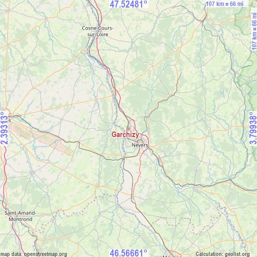
Garchizy GPS coordinates[2]
47° 2' 52.296" North, 3° 5' 46.5" East
| Map corner | latitude | longitude |
|---|---|---|
| Upper-left | 47.52481°, | 2.39313° |
| Center: | 47.04786°, | 3.09625° |
| Lower-right: | 46.56661°, | 3.79938° |
| Map W x H: | 106.5×106.5 km | = 66.2×66.2mi |
| max Lat: | 51.07786° ⇑54.8% North |
| Garchizy: | 47.04786° |
| min Lat: | ⇓45.2% South 41.3874° |
| min Long | Garchizy | max Long |
| -5.08615° | 3.09625° | 9.52242° |
| W 59.2%⇐ | ⇒40.8% E |
Elevation
Elevation of Garchizy is 215 m = 705 ft, and this is 21.3 m = 70 ft above average elevation for this country.
| Max E: |
2333 m = 7654 ft | 30.8% |
| Garchizy | 215 m 705 ft | |
| Avg. | 193.7 m = 635 ft | |
Min E: |
-1 m = -3 ft | 69.2% |
See also: France elevation on elevation.city.
Geographical zone
Garchizy is located in North temperate zone (between Tropic of Cancer and the Arctic Circle). Distance of this North polar circle is 2169.9 km =1348.3 mi to North.| Distance of | km | miles | from Garchizy |
|---|---|---|---|
| North Pole | 4775.8 | 2967.5 | to North |
| Arctic Circle | 2169.9 | 1348.3 | to North |
| Tropic Cancer | 2625.3 | 1631.3 | to South |
| Equator | 5231.2 | 3250.5 | to South |


Nearby cities:
15 places around Garchizy: (largest is in red/bold)
• Beffes
8.4 km =5.2 mi,  307°
307°
• Chaulgnes
9 km =5.6 mi,  3°
3°
• Coulanges-lès-Nevers
8.4 km =5.2 mi,  124°
124°
• Cours-les-Barres
5.5 km =3.4 mi,  242°
242°
• Fourchambault
3.6 km =2.2 mi,  195°
195°
• Germigny-sur-Loire
6.2 km =3.9 mi, 309°
• Guérigny
9.1 km =5.7 mi,  61°
61°
• Jouet-sur-l'Aubois
8.3 km =5.2 mi,  268°
268°
• Marseilles-lès-Aubigny
6.7 km =4.2 mi,  288°
288°
• Marzy
7.4 km =4.6 mi,  181°
181°
• Nevers
8 km =5 mi,  143°
143°
• Parigny-les-Vaux
6.3 km =3.9 mi,  39°
39°
• Pougues-les-Eaux
3.1 km =1.9 mi,  7°
7°
• Urzy
8.1 km =5 mi,  89°
89°
• Varennes-Vauzelles
4.8 km =3 mi, 135°
Sources, notices
• [Note1] Compared only with cities in France existing in our database
• [Src1] Map data: © OpenStreetMap contributors (CC-BY-SA)
• [Src2] Other city data from geonames.org with taken over terms of usage.
• [Src3] Geographical zone / Annual Mean Temperature by Robert A. Rohde @ Wikipedia
