Froissy geodata
Froissy (Hauts-de-France) is a populated place; located in France in Europe/Paris (GMT+2) time zone. With population of 946 people, there are 9233 cities with bigger population in this country. Compared to other cities in France, 90.2% of cities are located further ↓South; 54% of cities are located further →East and 60.5% of cities have lower elevation than Froissy. Note1
Administrative division(s):
- Level 1: Hauts-de-France
- Level 2: Département de l'Oise
- Level 3: Arrondissement de Clermont
- Level 4: Froissy


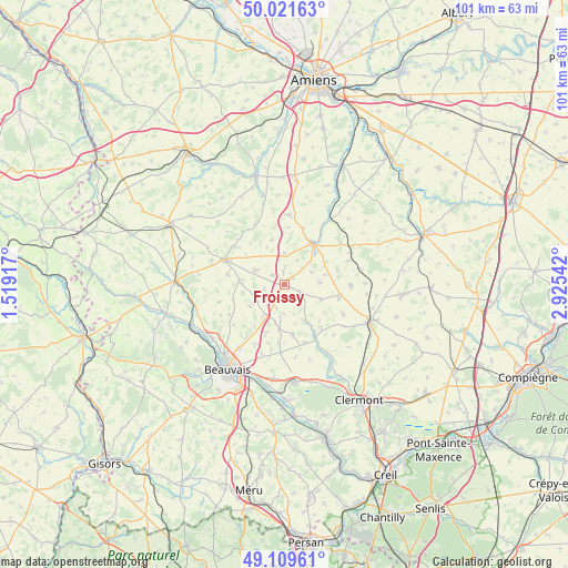
Froissy GPS coordinates[2]
49° 34' 3.9" North, 2° 13' 20.28" East
| Map corner | latitude | longitude |
|---|---|---|
| Upper-left | 50.02163°, | 1.51917° |
| Center: | 49.56775°, | 2.2223° |
| Lower-right: | 49.10961°, | 2.92542° |
| Map W x H: | 101.4×101.4 km | = 63×63mi |
| max Lat: | 51.07786° ⇑9.8% North |
| Froissy: | 49.56775° |
| min Lat: | ⇓90.2% South 41.3874° |
| min Long | Froissy | max Long |
| -5.08615° | 2.2223° | 9.52242° |
| W 46%⇐ | ⇒54% E |
Elevation
Elevation of Froissy is 172 m = 564 ft, and this is 21.7 m = 71 ft below average elevation for this country.
| Max E: |
2333 m = 7654 ft | 39.5% |
| Avg. | 193.7 m = 635 ft | |
| Froissy | 172 m = 564 ft | |
Min E: |
-1 m = -3 ft | 60.5% |
See also: France elevation on elevation.city.
Geographical zone
Froissy is located in North temperate zone (between Tropic of Cancer and the Arctic Circle). Distance of this North polar circle is 1889.8 km =1174.3 mi to North.| Distance of | km | miles | from Froissy |
|---|---|---|---|
| North Pole | 4495.6 | 2793.4 | to North |
| Arctic Circle | 1889.8 | 1174.3 | to North |
| Tropic Cancer | 2905.5 | 1805.4 | to South |
| Equator | 5511.4 | 3424.6 | to South |


Nearby cities:
15 places around Froissy: (largest is in red/bold)
• Abbeville-Saint-Lucien
6.9 km =4.3 mi,  213°
213°
• Ansauvillers
11.9 km =7.4 mi,  91°
91°
• Bonneuil-les-Eaux
12.4 km =7.7 mi,  4°
4°
• Breteuil
9 km =5.6 mi,  35°
35°
• Catillon-Fumechon
11.9 km =7.4 mi,  118°
118°
• Crèvecœur-le-Grand
10.6 km =6.6 mi,  289°
289°
• Esquennoy
10.6 km =6.6 mi,  18°
18°
• Hardivillers
5.5 km =3.4 mi, 0°
• Haudivillers
9 km =5.6 mi,  170°
170°
• Luchy
7.6 km =4.7 mi,  259°
259°
• Noyers-Saint-Martin
3.3 km =2.1 mi, 119°
• Oroër
9.1 km =5.7 mi, 208°
• Saint-André-Farivillers
5.4 km =3.4 mi,  66°
66°
• Verderel-lès-Sauqueuse
11.6 km =7.2 mi,  229°
229°
• Wavignies
10.2 km =6.3 mi,  102°
102°
Sources, notices
• [Note1] Compared only with cities in France existing in our database
• [Src1] Map data: © OpenStreetMap contributors (CC-BY-SA)
• [Src2] Other city data from geonames.org with taken over terms of usage.
• [Src3] Geographical zone / Annual Mean Temperature by Robert A. Rohde @ Wikipedia
