Oroër geodata
Oroër (Hauts-de-France) is a populated place; located in France in Europe/Paris (GMT+2) time zone. With population of 567 people, there are 13878 cities with bigger population in this country. Compared to other cities in France, 89.2% of cities are located further ↓South; 55% of cities are located further →East and 53.1% of cities have lower elevation than Oroër. Note1
Administrative division(s):
- Level 1: Hauts-de-France
- Level 2: Département de l'Oise
- Level 3: Arrondissement de Beauvais
- Level 4: Oroër


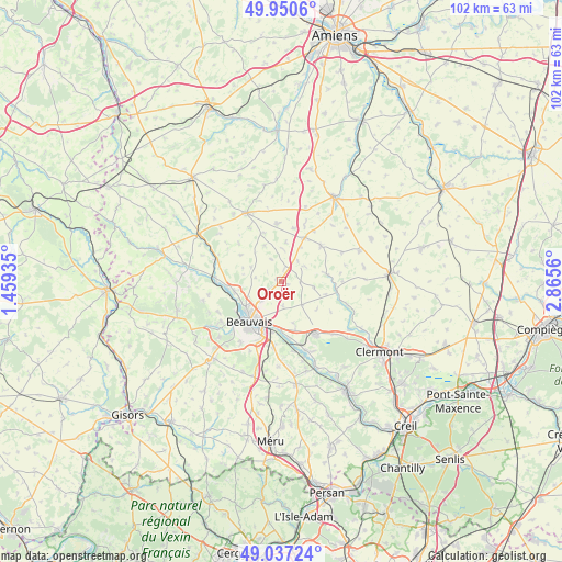
Oroër GPS coordinates[2]
49° 29' 45.78" North, 2° 9' 44.892" East
| Map corner | latitude | longitude |
|---|---|---|
| Upper-left | 49.9506°, | 1.45935° |
| Center: | 49.49605°, | 2.16247° |
| Lower-right: | 49.03724°, | 2.8656° |
| Map W x H: | 101.6×101.6 km | = 63.1×63.1mi |
| max Lat: | 51.07786° ⇑10.8% North |
| Oroër: | 49.49605° |
| min Lat: | ⇓89.2% South 41.3874° |
| min Long | Oroër | max Long |
| -5.08615° | 2.16247° | 9.52242° |
| W 45%⇐ | ⇒55% E |
Elevation
Elevation of Oroër is 143 m = 469 ft, and this is 50.7 m = 166 ft below average elevation for this country.
| Max E: |
2333 m = 7654 ft | 46.9% |
| Avg. | 193.7 m = 635 ft | |
| Oroër | 143 m = 469 ft | |
Min E: |
-1 m = -3 ft | 53.1% |
See also: France elevation on elevation.city.
Geographical zone
Oroër is located in North temperate zone (between Tropic of Cancer and the Arctic Circle). Distance of this North polar circle is 1897.7 km =1179.2 mi to North.| Distance of | km | miles | from Oroër |
|---|---|---|---|
| North Pole | 4503.6 | 2798.4 | to North |
| Arctic Circle | 1897.7 | 1179.2 | to North |
| Tropic Cancer | 2897.5 | 1800.4 | to South |
| Equator | 5503.4 | 3419.7 | to South |


Nearby cities:
15 places around Oroër: (largest is in red/bold)
• Abbeville-Saint-Lucien
2.3 km =1.4 mi,  11°
11°
• Allonne
10.3 km =6.4 mi,  199°
199°
• Beauvais
9 km =5.6 mi,  219°
219°
• Bresles
11.4 km =7.1 mi,  146°
146°
• Froissy
9.1 km =5.7 mi,  28°
28°
• Haudivillers
5.9 km =3.7 mi,  98°
98°
• Herchies
11 km =6.8 mi,  265°
265°
• Laversines
8.3 km =5.2 mi,  162°
162°
• Luchy
7.3 km =4.5 mi,  334°
334°
• Noyers-Saint-Martin
9.6 km =6 mi,  48°
48°
• Rochy-Condé
10.7 km =6.6 mi,  171°
171°
• Therdonne
8.6 km =5.3 mi,  181°
181°
• Tillé
5.2 km =3.2 mi,  226°
226°
• Troissereux
8.7 km =5.4 mi,  258°
258°
• Verderel-lès-Sauqueuse
4.5 km =2.8 mi,  275°
275°
Sources, notices
• [Note1] Compared only with cities in France existing in our database
• [Src1] Map data: © OpenStreetMap contributors (CC-BY-SA)
• [Src2] Other city data from geonames.org with taken over terms of usage.
• [Src3] Geographical zone / Annual Mean Temperature by Robert A. Rohde @ Wikipedia
