Therdonne geodata
Therdonne (Hauts-de-France) is a populated place; located in France in Europe/Paris (GMT+2) time zone. With population of 837 people, there are 10216 cities with bigger population in this country. Compared to other cities in France, 88.3% of cities are located further ↓South; 55% of cities are located further →East and 74.1% of cities have higher elevation than Therdonne. Note1
Administrative division(s):
- Level 1: Hauts-de-France
- Level 2: Département de l'Oise
- Level 3: Arrondissement de Beauvais
- Level 4: Therdonne


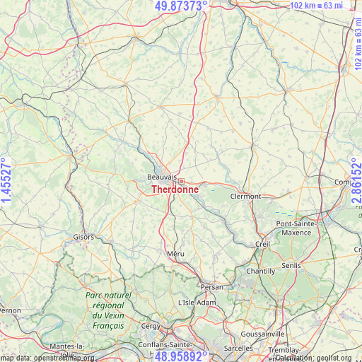
Therdonne GPS coordinates[2]
49° 25' 6.456" North, 2° 9' 30.204" East
| Map corner | latitude | longitude |
|---|---|---|
| Upper-left | 49.87373°, | 1.45527° |
| Center: | 49.41846°, | 2.15839° |
| Lower-right: | 48.95892°, | 2.86152° |
| Map W x H: | 101.7×101.7 km | = 63.2×63.2mi |
| max Lat: | 51.07786° ⇑11.7% North |
| Therdonne: | 49.41846° |
| min Lat: | ⇓88.3% South 41.3874° |
| min Long | Therdonne | max Long |
| -5.08615° | 2.15839° | 9.52242° |
| W 45%⇐ | ⇒55% E |
Elevation
Elevation of Therdonne is 69 m = 226 ft, and this is 124.7 m = 409 ft below average elevation for this country.
| Max E: |
2333 m = 7654 ft | 74.1% |
| Avg. | 193.7 m = 635 ft | |
| Therdonne | 69 m = 226 ft | |
Min E: |
-1 m = -3 ft | 25.9% |
See also: France elevation on elevation.city.
Geographical zone
Therdonne is located in North temperate zone (between Tropic of Cancer and the Arctic Circle). Distance of this North polar circle is 1906.4 km =1184.6 mi to North.| Distance of | km | miles | from Therdonne |
|---|---|---|---|
| North Pole | 4512.2 | 2803.8 | to North |
| Arctic Circle | 1906.4 | 1184.6 | to North |
| Tropic Cancer | 2888.9 | 1795.1 | to South |
| Equator | 5494.8 | 3414.3 | to South |


Nearby cities:
15 places around Therdonne: (largest is in red/bold)
• Allonne
3.4 km =2.1 mi,  251°
251°
• Aux Marais
8.4 km =5.2 mi,  267°
267°
• Bailleul-sur-Thérain
5.9 km =3.7 mi,  128°
128°
• Beauvais
5.7 km =3.5 mi,  286°
286°
• Bresles
6.7 km =4.2 mi,  97°
97°
• Frocourt
6.7 km =4.2 mi,  233°
233°
• Laversines
2.9 km =1.8 mi,  75°
75°
• Oroër
8.6 km =5.3 mi,  1°
1°
• Ponchon
8.5 km =5.3 mi,  160°
160°
• Rochy-Condé
2.7 km =1.7 mi, 134°
• Saint-Martin-le-Nœud
7.5 km =4.7 mi, 250°
• Saint-Sulpice
8 km =5 mi,  198°
198°
• Tillé
6.2 km =3.9 mi,  325°
325°
• Villers-Saint-Sépulcre
7.2 km =4.5 mi,  144°
144°
• Warluis
3.5 km =2.2 mi, 199°
Sources, notices
• [Note1] Compared only with cities in France existing in our database
• [Src1] Map data: © OpenStreetMap contributors (CC-BY-SA)
• [Src2] Other city data from geonames.org with taken over terms of usage.
• [Src3] Geographical zone / Annual Mean Temperature by Robert A. Rohde @ Wikipedia
