Rochy-Condé geodata
Rochy-Condé (Hauts-de-France) is a populated place; located in France in Europe/Paris (GMT+2) time zone. With population of 658 people, there are 12412 cities with bigger population in this country. Compared to other cities in France, 87.9% of cities are located further ↓South; 54.7% of cities are located further →East and 80.2% of cities have higher elevation than Rochy-Condé. Note1
Administrative division(s):
- Level 1: Hauts-de-France
- Level 2: Département de l'Oise
- Level 3: Arrondissement de Beauvais
- Level 4: Rochy-Condé


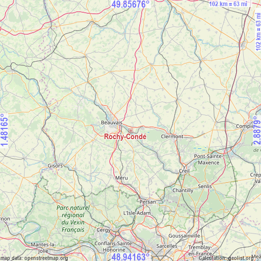
Rochy-Condé GPS coordinates[2]
49° 24' 4.788" North, 2° 11' 5.172" East
| Map corner | latitude | longitude |
|---|---|---|
| Upper-left | 49.85676°, | 1.48165° |
| Center: | 49.40133°, | 2.18477° |
| Lower-right: | 48.94163°, | 2.8879° |
| Map W x H: | 101.8×101.8 km | = 63.3×63.3mi |
| max Lat: | 51.07786° ⇑12.1% North |
| Rochy-Condé: | 49.40133° |
| min Lat: | ⇓87.9% South 41.3874° |
| min Long | Rochy-Condé | max Long |
| -5.08615° | 2.18477° | 9.52242° |
| W 45.3%⇐ | ⇒54.7% E |
Elevation
Elevation of Rochy-Condé is 54 m = 177 ft, and this is 139.7 m = 458 ft below average elevation for this country.
| Max E: |
2333 m = 7654 ft | 80.2% |
| Avg. | 193.7 m = 635 ft | |
| Rochy-Condé | 54 m = 177 ft | |
Min E: |
-1 m = -3 ft | 19.8% |
See also: France elevation on elevation.city.
Geographical zone
Rochy-Condé is located in North temperate zone (between Tropic of Cancer and the Arctic Circle). Distance of this North polar circle is 1908.3 km =1185.8 mi to North.| Distance of | km | miles | from Rochy-Condé |
|---|---|---|---|
| North Pole | 4514.1 | 2804.9 | to North |
| Arctic Circle | 1908.3 | 1185.8 | to North |
| Tropic Cancer | 2887 | 1793.9 | to South |
| Equator | 5492.9 | 3413.1 | to South |


Nearby cities:
15 places around Rochy-Condé: (largest is in red/bold)
• Allonne
5.2 km =3.2 mi,  279°
279°
• Bailleul-sur-Thérain
3.3 km =2.1 mi,  122°
122°
• Beauvais
8.2 km =5.1 mi,  295°
295°
• Berthecourt
6.3 km =3.9 mi,  152°
152°
• Bresles
4.8 km =3 mi,  77°
77°
• Frocourt
7.5 km =4.7 mi,  254°
254°
• Hermes
6.3 km =3.9 mi,  136°
136°
• La Rue-Saint-Pierre
8.1 km =5 mi, 83°
• Laversines
2.8 km =1.7 mi,  19°
19°
• Noailles
8.2 km =5.1 mi,  172°
172°
• Ponchon
6.2 km =3.9 mi, 171°
• Saint-Sulpice
7.2 km =4.5 mi,  218°
218°
• Therdonne
2.7 km =1.7 mi,  314°
314°
• Villers-Saint-Sépulcre
4.5 km =2.8 mi, 150°
• Warluis
3.4 km =2.1 mi, 245°
Sources, notices
• [Note1] Compared only with cities in France existing in our database
• [Src1] Map data: © OpenStreetMap contributors (CC-BY-SA)
• [Src2] Other city data from geonames.org with taken over terms of usage.
• [Src3] Geographical zone / Annual Mean Temperature by Robert A. Rohde @ Wikipedia
