Fontannes geodata
Fontannes (Auvergne-Rhône-Alpes) is a populated place; located in France in Europe/Paris (GMT+2) time zone. With population of 1,308 people, there are 6990 cities with bigger population in this country. Compared to other cities in France, 76.3% of cities are located further ↑North; 66.1% of cities are located further ←West and 99.3% of cities have lower elevation than Fontannes. Note1
Administrative division(s):
- Level 1: Auvergne-Rhône-Alpes
- Level 2: Haute-Loire
- Level 3: Arrondissement du Puy-en-Velay
- Level 4: Jullianges


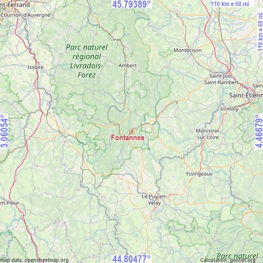
Fontannes GPS coordinates[2]
45° 18' 5.364" North, 3° 45' 49.176" East
| Map corner | latitude | longitude |
|---|---|---|
| Upper-left | 45.79389°, | 3.06054° |
| Center: | 45.30149°, | 3.76366° |
| Lower-right: | 44.80477°, | 4.46679° |
| Map W x H: | 110×110 km | = 68.4×68.4mi |
| max Lat: | 51.07786° ⇑76.3% North |
| Fontannes: | 45.30149° |
| min Lat: | ⇓23.7% South 41.3874° |
| min Long | Fontannes | max Long |
| -5.08615° | 3.76366° | 9.52242° |
| W 66.1%⇐ | ⇒33.9% E |
Elevation
Elevation of Fontannes is 1035 m = 3396 ft, and this is 841.3 m = 2760 ft above average elevation for this country.
| Max E: |
2333 m = 7654 ft | 0.7% |
| Fontannes | 1035 m 3396 ft | |
| Avg. | 193.7 m = 635 ft | |
Min E: |
-1 m = -3 ft | 99.3% |
See also: France elevation on elevation.city.
Geographical zone
Fontannes is located in North temperate zone (between Tropic of Cancer and the Arctic Circle). Distance of this North polar circle is 2364.1 km =1469 mi to North.| Distance of | km | miles | from Fontannes |
|---|---|---|---|
| North Pole | 4970 | 3088.2 | to North |
| Arctic Circle | 2364.1 | 1469 | to North |
| Tropic Cancer | 2431.1 | 1510.6 | to South |
| Equator | 5037.1 | 3129.9 | to South |


Nearby cities:
15 places around Fontannes: (largest is in red/bold)
• Allègre
12 km =7.5 mi,  199°
199°
• Arlanc
12.9 km =8 mi,  346°
346°
• Bellevue-la-Montagne
10 km =6.2 mi,  153°
153°
• Chomelix
6.6 km =4.1 mi,  131°
131°
• Craponne-sur-Arzon
7.4 km =4.6 mi,  63°
63°
• Estivareilles
23.1 km =14.4 mi, 56°
• La Chaise-Dieu
5.7 km =3.5 mi,  293°
293°
• Lavoûte-sur-Loire
23.2 km =14.4 mi, 151°
• Marsac-en-Livradois
19.9 km =12.4 mi, 351°
• Paulhaguet
22.2 km =13.8 mi,  242°
242°
• Saint-Paulien
18.8 km =11.7 mi,  168°
168°
• Saint-Vincent
20.9 km =13 mi, 146°
• Sauvessanges
13.2 km =8.2 mi,  40°
40°
• Usson-en-Forez
17.1 km =10.6 mi,  54°
54°
• Vorey
17.2 km =10.7 mi,  138°
138°
Sources, notices
• [Note1] Compared only with cities in France existing in our database
• [Src1] Map data: © OpenStreetMap contributors (CC-BY-SA)
• [Src2] Other city data from geonames.org with taken over terms of usage.
• [Src3] Geographical zone / Annual Mean Temperature by Robert A. Rohde @ Wikipedia
