Usson-en-Forez geodata
Usson-en-Forez (Auvergne-Rhône-Alpes) is a populated place; located in France in Europe/Paris (GMT+2) time zone. With population of 1,262 people, there are 7220 cities with bigger population in this country. Compared to other cities in France, 75.4% of cities are located further ↑North; 67.3% of cities are located further ←West and 98.8% of cities have lower elevation than Usson-en-Forez. Note1
Administrative division(s):
- Level 1: Auvergne-Rhône-Alpes
- Level 2: Département de la Loire
- Level 3: Arrondissement de Montbrison
- Level 4: Usson-en-Forez


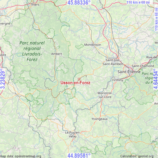
Usson-en-Forez GPS coordinates[2]
45° 23' 30.264" North, 3° 56' 29.112" East
| Map corner | latitude | longitude |
|---|---|---|
| Upper-left | 45.88336°, | 3.23829° |
| Center: | 45.39174°, | 3.94142° |
| Lower-right: | 44.89581°, | 4.64454° |
| Map W x H: | 109.8×109.8 km | = 68.2×68.2mi |
| max Lat: | 51.07786° ⇑75.4% North |
| Usson-en-Forez: | 45.39174° |
| min Lat: | ⇓24.6% South 41.3874° |
| min Long | Usson-en-Forez | max Long |
| -5.08615° | 3.94142° | 9.52242° |
| W 67.3%⇐ | ⇒32.7% E |
Elevation
Elevation of Usson-en-Forez is 929 m = 3048 ft, and this is 735.3 m = 2412 ft above average elevation for this country.
| Max E: |
2333 m = 7654 ft | 1.2% |
| Usson-en-Forez | 929 m 3048 ft | |
| Avg. | 193.7 m = 635 ft | |
Min E: |
-1 m = -3 ft | 98.8% |
See also: France elevation on elevation.city.
Geographical zone
Usson-en-Forez is located in North temperate zone (between Tropic of Cancer and the Arctic Circle). Distance of this North polar circle is 2354.1 km =1462.8 mi to North.| Distance of | km | miles | from Usson-en-Forez |
|---|---|---|---|
| North Pole | 4960 | 3082 | to North |
| Arctic Circle | 2354.1 | 1462.8 | to North |
| Tropic Cancer | 2441.2 | 1516.9 | to South |
| Equator | 5047.1 | 3136.1 | to South |


Nearby cities:
15 places around Usson-en-Forez: (largest is in red/bold)
• Arlanc
17.1 km =10.6 mi,  278°
278°
• Bas-en-Basset
16.2 km =10.1 mi,  126°
126°
• Boisset-Saint-Priest
18.5 km =11.5 mi,  43°
43°
• Chomelix
16.9 km =10.5 mi,  211°
211°
• Craponne-sur-Arzon
9.9 km =6.2 mi,  227°
227°
• Estivareilles
6 km =3.7 mi,  61°
61°
• Fontannes
17.1 km =10.6 mi, 234°
• Luriecq
12.5 km =7.8 mi, 59°
• Margerie-Chantagret
17.8 km =11.1 mi,  33°
33°
• Périgneux
17.6 km =10.9 mi,  71°
71°
• Saint-Anthème
15.3 km =9.5 mi,  352°
352°
• Saint-Bonnet-le-Château
10.4 km =6.5 mi, 69°
• Saint-Jean-Soleymieux
14.3 km =8.9 mi, 31°
• Saint-Nizier-de-Fornas
11 km =6.8 mi,  83°
83°
• Sauvessanges
5.4 km =3.4 mi,  271°
271°
Sources, notices
• [Note1] Compared only with cities in France existing in our database
• [Src1] Map data: © OpenStreetMap contributors (CC-BY-SA)
• [Src2] Other city data from geonames.org with taken over terms of usage.
• [Src3] Geographical zone / Annual Mean Temperature by Robert A. Rohde @ Wikipedia
