Arlanc geodata
Arlanc (Auvergne-Rhône-Alpes) is a populated place; located in France in Europe/Paris (GMT+2) time zone. With population of 1,895 people, there are 5045 cities with bigger population in this country. Compared to other cities in France, 75.1% of cities are located further ↑North; 65.9% of cities are located further ←West and 95.4% of cities have lower elevation than Arlanc. Note1
Administrative division(s):
- Level 1: Auvergne-Rhône-Alpes
- Level 2: Département du Puy-de-Dôme
- Level 3: Ambert
- Level 4: Arlanc


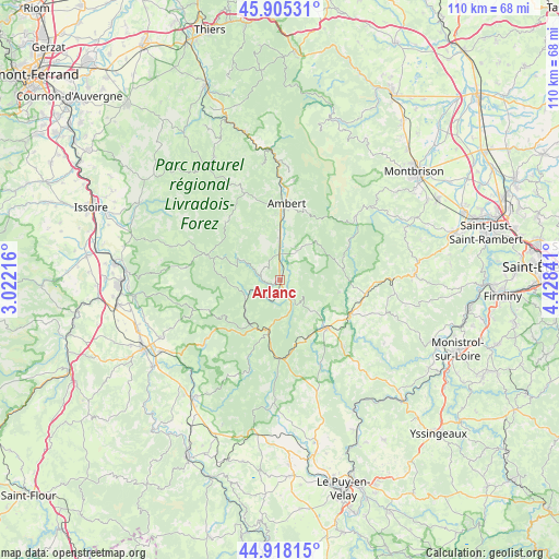
Arlanc GPS coordinates[2]
45° 24' 50.004" North, 3° 43' 31.008" East
| Map corner | latitude | longitude |
|---|---|---|
| Upper-left | 45.90531°, | 3.02216° |
| Center: | 45.41389°, | 3.72528° |
| Lower-right: | 44.91815°, | 4.42841° |
| Map W x H: | 109.8×109.8 km | = 68.2×68.2mi |
| max Lat: | 51.07786° ⇑75.1% North |
| Arlanc: | 45.41389° |
| min Lat: | ⇓24.9% South 41.3874° |
| min Long | Arlanc | max Long |
| -5.08615° | 3.72528° | 9.52242° |
| W 65.9%⇐ | ⇒34.1% E |
Elevation
Elevation of Arlanc is 609 m = 1998 ft, and this is 415.3 m = 1363 ft above average elevation for this country.
| Max E: |
2333 m = 7654 ft | 4.6% |
| Arlanc | 609 m 1998 ft | |
| Avg. | 193.7 m = 635 ft | |
Min E: |
-1 m = -3 ft | 95.4% |
See also: France elevation on elevation.city.
Geographical zone
Arlanc is located in North temperate zone (between Tropic of Cancer and the Arctic Circle). Distance of this North polar circle is 2351.6 km =1461.2 mi to North.| Distance of | km | miles | from Arlanc |
|---|---|---|---|
| North Pole | 4957.5 | 3080.4 | to North |
| Arctic Circle | 2351.6 | 1461.2 | to North |
| Tropic Cancer | 2443.6 | 1518.4 | to South |
| Equator | 5049.6 | 3137.7 | to South |


Nearby cities:
15 places around Arlanc: (largest is in red/bold)
• Ambert
15.1 km =9.4 mi,  4°
4°
• Chomelix
18.7 km =11.6 mi,  154°
154°
• Craponne-sur-Arzon
13.3 km =8.3 mi,  133°
133°
• Estivareilles
22.1 km =13.7 mi,  89°
89°
• Fontannes
12.9 km =8 mi,  166°
166°
• Fournols
15.7 km =9.8 mi,  317°
317°
• La Chaise-Dieu
10.5 km =6.5 mi,  192°
192°
• Marsac-en-Livradois
7.2 km =4.5 mi, 1°
• Saint-Amant-Roche-Savine
19.4 km =12.1 mi,  338°
338°
• Saint-Anthème
19.6 km =12.2 mi,  49°
49°
• Saint-Ferréol-des-Côtes
12.8 km =8 mi,  353°
353°
• Saint-Germain-l’Herm
15.2 km =9.4 mi,  289°
289°
• Sauvessanges
11.8 km =7.3 mi,  101°
101°
• Usson-en-Forez
17.1 km =10.6 mi, 98°
• Vernet-la-Varenne
22.4 km =13.9 mi, 287°
Sources, notices
• [Note1] Compared only with cities in France existing in our database
• [Src1] Map data: © OpenStreetMap contributors (CC-BY-SA)
• [Src2] Other city data from geonames.org with taken over terms of usage.
• [Src3] Geographical zone / Annual Mean Temperature by Robert A. Rohde @ Wikipedia
