Romilly-sur-Andelle geodata
Romilly-sur-Andelle (Normandy) is a populated place; located in France in Europe/Paris (GMT+2) time zone. With population of 2,789 people, there are 3503 cities with bigger population in this country. Compared to other cities in France, 86.7% of cities are located further ↓South; 66% of cities are located further →East and 96.7% of cities have higher elevation than Romilly-sur-Andelle. Note1
Administrative division(s):
- Level 1: Normandy
- Level 2: Département de l'Eure
- Level 3: Les Andelys
- Level 4: Romilly-sur-Andelle


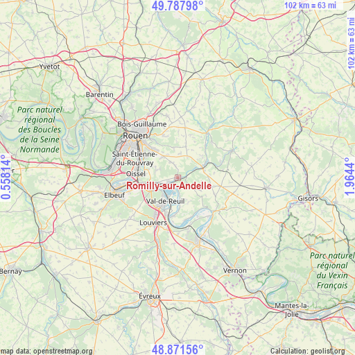
Romilly-sur-Andelle GPS coordinates[2]
49° 19' 54.84" North, 1° 15' 40.572" East
| Map corner | latitude | longitude |
|---|---|---|
| Upper-left | 49.78798°, | 0.55814° |
| Center: | 49.3319°, | 1.26127° |
| Lower-right: | 48.87156°, | 1.9644° |
| Map W x H: | 101.9×101.9 km | = 63.3×63.3mi |
| max Lat: | 51.07786° ⇑13.3% North |
| Romilly-sur-Andelle: | 49.3319° |
| min Lat: | ⇓86.7% South 41.3874° |
| min Long | Romilly-sur-And | max Long |
| -5.08615° | 1.26127° | 9.52242° |
| W 34%⇐ | ⇒66% E |
Elevation
Elevation of Romilly-sur-Andelle is 12 m = 39 ft, and this is 181.7 m = 596 ft below average elevation for this country.
| Max E: |
2333 m = 7654 ft | 96.7% |
| Avg. | 193.7 m = 635 ft | |
| Romilly-sur-Andelle | 12 m = 39 ft | |
Min E: |
-1 m = -3 ft | 3.3% |
See also: France elevation on elevation.city.
Geographical zone
Romilly-sur-Andelle is located in North temperate zone (between Tropic of Cancer and the Arctic Circle). Distance of this North polar circle is 1916 km =1190.5 mi to North.| Distance of | km | miles | from Romilly-sur-Andelle |
|---|---|---|---|
| North Pole | 4521.9 | 2809.8 | to North |
| Arctic Circle | 1916 | 1190.5 | to North |
| Tropic Cancer | 2879.3 | 1789.1 | to South |
| Equator | 5485.2 | 3408.3 | to South |


Nearby cities:
15 places around Romilly-sur-Andelle: (largest is in red/bold)
• Alizay
6.1 km =3.8 mi,  259°
259°
• Boos
7.6 km =4.7 mi,  326°
326°
• Bourg-Beaudouin
7 km =4.3 mi,  29°
29°
• Fleury-sur-Andelle
7.6 km =4.7 mi,  64°
64°
• Le Manoir
4.6 km =2.9 mi,  243°
243°
• Les Damps
6.9 km =4.3 mi, 241°
• Léry
6.4 km =4 mi,  217°
217°
• Mesnil-Raoul
7.3 km =4.5 mi,  7°
7°
• Pont-Saint-Pierre
1.1 km =0.7 mi,  68°
68°
• Poses
3.2 km =2 mi,  203°
203°
• Pîtres
2.6 km =1.6 mi,  230°
230°
• Quévreville-la-Poterie
5.8 km =3.6 mi,  296°
296°
• Radepont
5.3 km =3.3 mi, 65°
• Val-de-Reuil
7.4 km =4.6 mi,  209°
209°
• Ymare
6.3 km =3.9 mi,  289°
289°
Sources, notices
• [Note1] Compared only with cities in France existing in our database
• [Src1] Map data: © OpenStreetMap contributors (CC-BY-SA)
• [Src2] Other city data from geonames.org with taken over terms of usage.
• [Src3] Geographical zone / Annual Mean Temperature by Robert A. Rohde @ Wikipedia
