Festubert geodata
Festubert (Hauts-de-France) is a populated place; located in France in Europe/Paris (GMT+2) time zone. With population of 1,147 people, there are 7844 cities with bigger population in this country. Compared to other cities in France, 97.7% of cities are located further ↓South; 54% of cities are located further ←West and 93.9% of cities have higher elevation than Festubert. Note1
Administrative division(s):
- Level 1: Hauts-de-France
- Level 2: Pas-de-Calais
- Level 3: Arrondissement de Béthune
- Level 4: Festubert


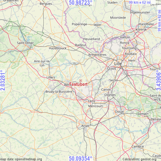
Festubert GPS coordinates[2]
50° 32' 33" North, 2° 44' 9.348" East
| Map corner | latitude | longitude |
|---|---|---|
| Upper-left | 50.98723°, | 2.03281° |
| Center: | 50.5425°, | 2.73593° |
| Lower-right: | 50.09354°, | 3.43906° |
| Map W x H: | 99.4×99.4 km | = 61.8×61.8mi |
| max Lat: | 51.07786° ⇑2.3% North |
| Festubert: | 50.5425° |
| min Lat: | ⇓97.7% South 41.3874° |
| min Long | Festubert | max Long |
| -5.08615° | 2.73593° | 9.52242° |
| W 54%⇐ | ⇒46% E |
Elevation
Elevation of Festubert is 20 m = 66 ft, and this is 173.7 m = 570 ft below average elevation for this country.
| Max E: |
2333 m = 7654 ft | 93.9% |
| Avg. | 193.7 m = 635 ft | |
| Festubert | 20 m = 66 ft | |
Min E: |
-1 m = -3 ft | 6.1% |
See also: France elevation on elevation.city.
Geographical zone
Festubert is located in North temperate zone (between Tropic of Cancer and the Arctic Circle). Distance of this North polar circle is 1781.4 km =1106.9 mi to North.| Distance of | km | miles | from Festubert |
|---|---|---|---|
| North Pole | 4387.3 | 2726.1 | to North |
| Arctic Circle | 1781.4 | 1106.9 | to North |
| Tropic Cancer | 3013.9 | 1872.8 | to South |
| Equator | 5619.8 | 3492 | to South |


Nearby cities:
15 places around Festubert: (largest is in red/bold)
• Annequin
4.3 km =2.7 mi,  195°
195°
• Auchy-les-Mines
4.6 km =2.9 mi,  134°
134°
• Beuvry
4.6 km =2.9 mi,  231°
231°
• Cambrin
3.7 km =2.3 mi,  174°
174°
• Cuinchy
2.9 km =1.8 mi,  161°
161°
• Essars
5 km =3.1 mi,  277°
277°
• Haisnes
5.6 km =3.5 mi, 133°
• La Bassée
5.1 km =3.2 mi,  100°
100°
• La Couture
4.9 km =3 mi,  335°
335°
• Lorgies
4.8 km =3 mi,  52°
52°
• Neuve-Chapelle
5.8 km =3.6 mi,  34°
34°
• Richebourg
4.5 km =2.8 mi,  357°
357°
• Richebourg-l'Avoué
3.2 km =2 mi,  16°
16°
• Sailly-Labourse
5.4 km =3.4 mi,  210°
210°
• Violaines
3.7 km =2.3 mi,  91°
91°
Sources, notices
• [Note1] Compared only with cities in France existing in our database
• [Src1] Map data: © OpenStreetMap contributors (CC-BY-SA)
• [Src2] Other city data from geonames.org with taken over terms of usage.
• [Src3] Geographical zone / Annual Mean Temperature by Robert A. Rohde @ Wikipedia
