Haisnes geodata
Haisnes (Hauts-de-France) is a populated place; located in France in Europe/Paris (GMT+2) time zone. With population of 4,436 people, there are 2222 cities with bigger population in this country. Compared to other cities in France, 97.4% of cities are located further ↓South; 54.8% of cities are located further ←West and 91.2% of cities have higher elevation than Haisnes. Note1
Administrative division(s):
- Level 1: Hauts-de-France
- Level 2: Pas-de-Calais
- Level 3: Arrondissement de Béthune
- Level 4: Haisnes


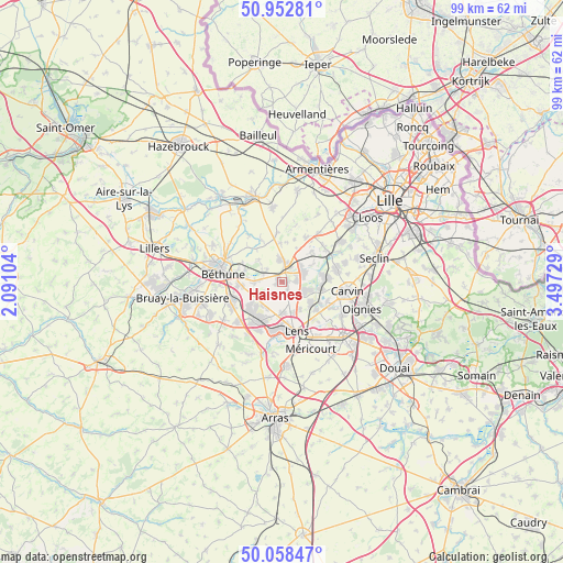
Haisnes GPS coordinates[2]
50° 30' 27.936" North, 2° 47' 38.976" East
| Map corner | latitude | longitude |
|---|---|---|
| Upper-left | 50.95281°, | 2.09104° |
| Center: | 50.50776°, | 2.79416° |
| Lower-right: | 50.05847°, | 3.49729° |
| Map W x H: | 99.4×99.4 km | = 61.8×61.8mi |
| max Lat: | 51.07786° ⇑2.6% North |
| Haisnes: | 50.50776° |
| min Lat: | ⇓97.4% South 41.3874° |
| min Long | Haisnes | max Long |
| -5.08615° | 2.79416° | 9.52242° |
| W 54.8%⇐ | ⇒45.2% E |
Elevation
Elevation of Haisnes is 27 m = 89 ft, and this is 166.7 m = 547 ft below average elevation for this country.
| Max E: |
2333 m = 7654 ft | 91.2% |
| Avg. | 193.7 m = 635 ft | |
| Haisnes | 27 m = 89 ft | |
Min E: |
-1 m = -3 ft | 8.8% |
See also: France elevation on elevation.city.
Geographical zone
Haisnes is located in North temperate zone (between Tropic of Cancer and the Arctic Circle). Distance of this North polar circle is 1785.2 km =1109.3 mi to North.| Distance of | km | miles | from Haisnes |
|---|---|---|---|
| North Pole | 4391.1 | 2728.5 | to North |
| Arctic Circle | 1785.2 | 1109.3 | to North |
| Tropic Cancer | 3010 | 1870.3 | to South |
| Equator | 5615.9 | 3489.6 | to South |


Nearby cities:
15 places around Haisnes: (largest is in red/bold)
• Annequin
5.2 km =3.2 mi,  266°
266°
• Auchy-les-Mines
1 km =0.6 mi,  308°
308°
• Billy-Berclau
5.2 km =3.2 mi,  77°
77°
• Cambrin
3.8 km =2.4 mi, 273°
• Cuinchy
3.4 km =2.1 mi,  288°
288°
• Douvrin
2.6 km =1.6 mi,  86°
86°
• Festubert
5.6 km =3.5 mi, 313°
• Hulluch
2.4 km =1.5 mi,  147°
147°
• La Bassée
3.1 km =1.9 mi,  16°
16°
• Loos-en-Gohelle
5.6 km =3.5 mi,  181°
181°
• Noyelles-lès-Vermelles
5.2 km =3.2 mi,  247°
247°
• Salomé
4.7 km =2.9 mi,  52°
52°
• Vermelles
3.9 km =2.4 mi,  238°
238°
• Violaines
3.8 km =2.4 mi,  354°
354°
• Wingles
4.6 km =2.9 mi,  109°
109°
Sources, notices
• [Note1] Compared only with cities in France existing in our database
• [Src1] Map data: © OpenStreetMap contributors (CC-BY-SA)
• [Src2] Other city data from geonames.org with taken over terms of usage.
• [Src3] Geographical zone / Annual Mean Temperature by Robert A. Rohde @ Wikipedia
