Fère-Champenoise geodata
Fère-Champenoise (Grand Est) is a populated place; located in France in Europe/Paris (GMT+2) time zone. With population of 2,339 people, there are 4125 cities with bigger population in this country. Compared to other cities in France, 74.4% of cities are located further ↓South; 67.7% of cities are located further ←West and 56.2% of cities have higher elevation than Fère-Champenoise. Note1
Administrative division(s):
- Level 1: Grand Est
- Level 2: Marne
- Level 3: Arrondissement d'Épernay
- Level 4: Fère-Champenoise


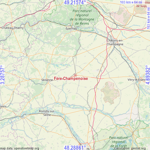
Fère-Champenoise GPS coordinates[2]
48° 45' 15.516" North, 3° 59' 26.484" East
| Map corner | latitude | longitude |
|---|---|---|
| Upper-left | 49.21574°, | 3.28757° |
| Center: | 48.75431°, | 3.99069° |
| Lower-right: | 48.28861°, | 4.69382° |
| Map W x H: | 103.1×103.1 km | = 64.1×64.1mi |
| max Lat: | 51.07786° ⇑25.6% North |
| Fère-Champenoise: | 48.75431° |
| min Lat: | ⇓74.4% South 41.3874° |
| min Long | Fère-Champenoi | max Long |
| -5.08615° | 3.99069° | 9.52242° |
| W 67.7%⇐ | ⇒32.3% E |
Elevation
Elevation of Fère-Champenoise is 113 m = 371 ft, and this is 80.7 m = 265 ft below average elevation for this country.
| Max E: |
2333 m = 7654 ft | 56.2% |
| Avg. | 193.7 m = 635 ft | |
| Fère-Champenoise | 113 m = 371 ft | |
Min E: |
-1 m = -3 ft | 43.8% |
See also: France elevation on elevation.city.
Geographical zone
Fère-Champenoise is located in North temperate zone (between Tropic of Cancer and the Arctic Circle). Distance of this North polar circle is 1980.2 km =1230.4 mi to North.| Distance of | km | miles | from Fère-Champenoise |
|---|---|---|---|
| North Pole | 4586.1 | 2849.7 | to North |
| Arctic Circle | 1980.2 | 1230.4 | to North |
| Tropic Cancer | 2815.1 | 1749.2 | to South |
| Equator | 5421 | 3368.5 | to South |


Nearby cities:
15 places around Fère-Champenoise: (largest is in red/bold)
• Anglure
22.8 km =14.2 mi,  214°
214°
• Avize
24.4 km =15.2 mi,  4°
4°
• Barbonne-Fayel
24.3 km =15.1 mi,  243°
243°
• Bergères-lès-Vertus
14 km =8.7 mi, 4°
• Connantre
5.8 km =3.6 mi, 237°
• Gaye
15.7 km =9.8 mi, 240°
• Grauves
24.5 km =15.2 mi,  355°
355°
• Le Mesnil-sur-Oger
21.6 km =13.4 mi,  6°
6°
• Lucy
24.6 km =15.3 mi,  326°
326°
• Mailly-le-Camp
19.1 km =11.9 mi,  121°
121°
• Oger
22.7 km =14.1 mi, 4°
• Plancy-l'Abbaye
20.9 km =13 mi,  184°
184°
• Pleurs
11.2 km =7 mi,  231°
231°
• Sézanne
20 km =12.4 mi,  259°
259°
• Vertus
16.9 km =10.5 mi, 2°
Sources, notices
• [Note1] Compared only with cities in France existing in our database
• [Src1] Map data: © OpenStreetMap contributors (CC-BY-SA)
• [Src2] Other city data from geonames.org with taken over terms of usage.
• [Src3] Geographical zone / Annual Mean Temperature by Robert A. Rohde @ Wikipedia
