Barbonne-Fayel geodata
Barbonne-Fayel (Grand Est) is a populated place; located in France in Europe/Paris (GMT+2) time zone. With population of 510 people, there are 15036 cities with bigger population in this country. Compared to other cities in France, 72.2% of cities are located further ↓South; 65.7% of cities are located further ←West and 55.9% of cities have higher elevation than Barbonne-Fayel. Note1
Administrative division(s):
- Level 1: Grand Est
- Level 2: Marne
- Level 3: Arrondissement d'Épernay
- Level 4: Barbonne-Fayel


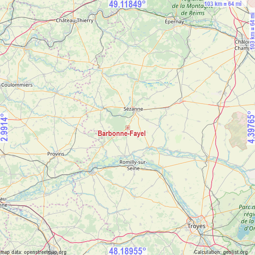
Barbonne-Fayel GPS coordinates[2]
48° 39' 22.176" North, 3° 41' 40.308" East
| Map corner | latitude | longitude |
|---|---|---|
| Upper-left | 49.11849°, | 2.9914° |
| Center: | 48.65616°, | 3.69453° |
| Lower-right: | 48.18955°, | 4.39765° |
| Map W x H: | 103.3×103.3 km | = 64.2×64.2mi |
| max Lat: | 51.07786° ⇑27.8% North |
| Barbonne-Fayel: | 48.65616° |
| min Lat: | ⇓72.2% South 41.3874° |
| min Long | Barbonne-Fayel | max Long |
| -5.08615° | 3.69453° | 9.52242° |
| W 65.7%⇐ | ⇒34.3% E |
Elevation
Elevation of Barbonne-Fayel is 114 m = 374 ft, and this is 79.7 m = 261 ft below average elevation for this country.
| Max E: |
2333 m = 7654 ft | 55.9% |
| Avg. | 193.7 m = 635 ft | |
| Barbonne-Fayel | 114 m = 374 ft | |
Min E: |
-1 m = -3 ft | 44.1% |
See also: France elevation on elevation.city.
Geographical zone
Barbonne-Fayel is located in North temperate zone (between Tropic of Cancer and the Arctic Circle). Distance of this North polar circle is 1991.1 km =1237.2 mi to North.| Distance of | km | miles | from Barbonne-Fayel |
|---|---|---|---|
| North Pole | 4597 | 2856.4 | to North |
| Arctic Circle | 1991.1 | 1237.2 | to North |
| Tropic Cancer | 2804.1 | 1742.4 | to South |
| Equator | 5410.1 | 3361.7 | to South |


Nearby cities:
15 places around Barbonne-Fayel: (largest is in red/bold)
• Anglure
11.8 km =7.3 mi,  131°
131°
• Clesles
17 km =10.6 mi,  143°
143°
• Conflans-sur-Seine
11.6 km =7.2 mi,  185°
185°
• Crancey
16 km =9.9 mi, 194°
• Esclavolles-Lurey
11.8 km =7.3 mi, 193°
• Esternay
12.9 km =8 mi,  310°
310°
• Gaye
8.7 km =5.4 mi,  68°
68°
• Maizières-la-Grande-Paroisse
17.6 km =10.9 mi,  157°
157°
• Marcilly-sur-Seine
11 km =6.8 mi,  174°
174°
• Pleurs
13.6 km =8.5 mi, 73°
• Pont-sur-Seine
17 km =10.6 mi,  205°
205°
• Romilly-sur-Seine
16.3 km =10.1 mi, 171°
• Saint-Just-Sauvage
13.1 km =8.1 mi,  149°
149°
• Sézanne
7.5 km =4.7 mi,  16°
16°
• Villenauxe-la-Grande
13.4 km =8.3 mi,  232°
232°
Sources, notices
• [Note1] Compared only with cities in France existing in our database
• [Src1] Map data: © OpenStreetMap contributors (CC-BY-SA)
• [Src2] Other city data from geonames.org with taken over terms of usage.
• [Src3] Geographical zone / Annual Mean Temperature by Robert A. Rohde @ Wikipedia
