Eyvigues-et-Eybènes geodata
Eyvigues-et-Eybènes (Nouvelle-Aquitaine) is a populated place; located in France in Europe/Paris (GMT+2) time zone. With population of 1,164 people, there are 7742 cities with bigger population in this country. Compared to other cities in France, 80.2% of cities are located further ↑North; 65% of cities are located further →East and 77.6% of cities have lower elevation than Eyvigues-et-Eybènes. Note1
Administrative division(s):
- Level 1: Nouvelle-Aquitaine
- Level 2: Dordogne
- Level 3: Arrondissement de Sarlat-la-Canéda
- Level 4: Salignac-Eyvigues


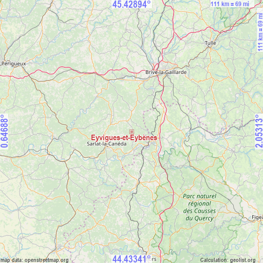
Eyvigues-et-Eybènes GPS coordinates[2]
44° 55' 59.988" North, 1° 21' 0" East
| Map corner | latitude | longitude |
|---|---|---|
| Upper-left | 45.42894°, | 0.64688° |
| Center: | 44.93333°, | 1.35° |
| Lower-right: | 44.43341°, | 2.05313° |
| Map W x H: | 110.7×110.7 km | = 68.8×68.8mi |
| max Lat: | 51.07786° ⇑80.2% North |
| Eyvigues-et-Eybènes: | 44.93333° |
| min Lat: | ⇓19.8% South 41.3874° |
| min Long | Eyvigues-et-Eyb | max Long |
| -5.08615° | 1.35° | 9.52242° |
| W 35%⇐ | ⇒65% E |
Elevation
Elevation of Eyvigues-et-Eybènes is 269 m = 883 ft, and this is 75.3 m = 247 ft above average elevation for this country.
| Max E: |
2333 m = 7654 ft | 22.4% |
| Eyvigues-et-Eybènes | 269 m 883 ft | |
| Avg. | 193.7 m = 635 ft | |
Min E: |
-1 m = -3 ft | 77.6% |
See also: France elevation on elevation.city.
Geographical zone
Eyvigues-et-Eybènes is located in North temperate zone (between Tropic of Cancer and the Arctic Circle). Distance of this Northern Tropic circle is 2390.2 km =1485.2 mi to South.| Distance of | km | miles | from Eyvigues-et-Eybènes |
|---|---|---|---|
| North Pole | 5010.9 | 3113.6 | to North |
| Arctic Circle | 2405.1 | 1494.5 | to North |
| Tropic Cancer | 2390.2 | 1485.2 | to South |
| Equator | 4996.1 | 3104.4 | to South |


Nearby cities:
15 places around Eyvigues-et-Eybènes: (largest is in red/bold)
• Carlux
5.6 km =3.5 mi,  180°
180°
• Carsac-Aillac
13.6 km =8.5 mi,  215°
215°
• Gignac
11.7 km =7.3 mi,  46°
46°
• Groléjac
13.4 km =8.3 mi,  200°
200°
• Lachapelle-Auzac
11.2 km =7 mi,  92°
92°
• Lanzac
12.4 km =7.7 mi,  122°
122°
• Marcillac-Saint-Quentin
9.9 km =6.2 mi,  291°
291°
• Pinsac
15.6 km =9.7 mi, 124°
• Proissans
9.2 km =5.7 mi,  270°
270°
• Saint-Geniès
10.8 km =6.7 mi,  313°
313°
• Saint-Julien-de-Lampon
7.4 km =4.6 mi, 180°
• Salignac-Eyvigues
5 km =3.1 mi,  336°
336°
• Sarlat-la-Canéda
11.6 km =7.2 mi,  244°
244°
• Souillac
10.4 km =6.5 mi,  112°
112°
• Vitrac
13.6 km =8.5 mi, 215°
Sources, notices
• [Note1] Compared only with cities in France existing in our database
• [Src1] Map data: © OpenStreetMap contributors (CC-BY-SA)
• [Src2] Other city data from geonames.org with taken over terms of usage.
• [Src3] Geographical zone / Annual Mean Temperature by Robert A. Rohde @ Wikipedia
