Eycheil geodata
Eycheil (Occitanie) is a populated place; located in France in Europe/Paris (GMT+2) time zone. With population of 529 people, there are 14624 cities with bigger population in this country. Compared to other cities in France, 98.4% of cities are located further ↑North; 67.2% of cities are located further →East and 89.2% of cities have lower elevation than Eycheil. Note1
Administrative division(s):
- Level 1: Occitanie
- Level 2: Département de l'Ariège
- Level 3: Arrondissement de Saint-Girons
- Level 4: Eycheil


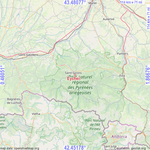
Eycheil GPS coordinates[2]
42° 58' 6.348" North, 1° 9' 49.104" East
| Map corner | latitude | longitude |
|---|---|---|
| Upper-left | 43.48077°, | 0.46051° |
| Center: | 42.96843°, | 1.16364° |
| Lower-right: | 42.45178°, | 1.86676° |
| Map W x H: | 114.4×114.4 km | = 71.1×71.1mi |
| max Lat: | 51.07786° ⇑98.4% North |
| Eycheil: | 42.96843° |
| min Lat: | ⇓1.6% South 41.3874° |
| min Long | Eycheil | max Long |
| -5.08615° | 1.16364° | 9.52242° |
| W 32.8%⇐ | ⇒67.2% E |
Elevation
Elevation of Eycheil is 410 m = 1345 ft, and this is 216.3 m = 710 ft above average elevation for this country.
| Max E: |
2333 m = 7654 ft | 10.8% |
| Eycheil | 410 m 1345 ft | |
| Avg. | 193.7 m = 635 ft | |
Min E: |
-1 m = -3 ft | 89.2% |
See also: France elevation on elevation.city.
Geographical zone
Eycheil is located in North temperate zone (between Tropic of Cancer and the Arctic Circle). Distance of this Northern Tropic circle is 2171.7 km =1349.4 mi to South.| Distance of | km | miles | from Eycheil |
|---|---|---|---|
| North Pole | 5229.4 | 3249.4 | to North |
| Arctic Circle | 2623.5 | 1630.2 | to North |
| Tropic Cancer | 2171.7 | 1349.4 | to South |
| Equator | 4777.6 | 2968.7 | to South |


Nearby cities:
15 places around Eycheil: (largest is in red/bold)
• Cassagne
22.1 km =13.7 mi,  320°
320°
• Ercé
16.9 km =10.5 mi,  142°
142°
• La Bastide-de-Sérou
22.1 km =13.7 mi,  77°
77°
• Mane
21.3 km =13.2 mi,  306°
306°
• Massat
17.4 km =10.8 mi,  120°
120°
• Montjoie-en-Couserans
3.8 km =2.4 mi,  355°
355°
• Moulis
5.9 km =3.7 mi,  262°
262°
• Oust
11.2 km =7 mi,  157°
157°
• Prat-Bonrepaux
14 km =8.7 mi,  301°
301°
• Rimont
10.1 km =6.3 mi,  72°
72°
• Saint-Girons
2.3 km =1.4 mi, 321°
• Saint-Lizier
4.3 km =2.7 mi,  329°
329°
• Sainte-Croix-Volvestre
18.3 km =11.4 mi,  0°
0°
• Salies-du-Salat
22.2 km =13.8 mi, 311°
• Seix
12 km =7.5 mi,  165°
165°
Sources, notices
• [Note1] Compared only with cities in France existing in our database
• [Src1] Map data: © OpenStreetMap contributors (CC-BY-SA)
• [Src2] Other city data from geonames.org with taken over terms of usage.
• [Src3] Geographical zone / Annual Mean Temperature by Robert A. Rohde @ Wikipedia
