Villers-le-Sec geodata
Villers-le-Sec (Bourgogne-Franche-Comté) is a populated place; located in France in Europe/Paris (GMT+2) time zone. With population of 505 people, there are 15148 cities with bigger population in this country. Compared to other cities in France, 52.6% of cities are located further ↓South; 89.5% of cities are located further ←West and 79.5% of cities have lower elevation than Villers-le-Sec. Note1
Administrative division(s):
- Level 1: Bourgogne-Franche-Comté
- Level 2: Département de la Haute-Saône
- Level 3: Arrondissement de Vesoul
- Level 4: Villers-le-Sec


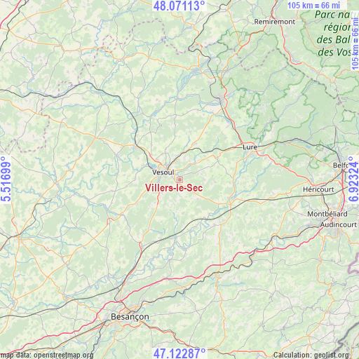
Villers-le-Sec GPS coordinates[2]
47° 35' 56.94" North, 6° 13' 12.396" East
| Map corner | latitude | longitude |
|---|---|---|
| Upper-left | 48.07113°, | 5.51699° |
| Center: | 47.59915°, | 6.22011° |
| Lower-right: | 47.12287°, | 6.92324° |
| Map W x H: | 105.4×105.4 km | = 65.5×65.5mi |
| max Lat: | 51.07786° ⇑47.4% North |
| Villers-le-Sec: | 47.59915° |
| min Lat: | ⇓52.6% South 41.3874° |
| min Long | Villers-le-Sec | max Long |
| -5.08615° | 6.22011° | 9.52242° |
| W 89.5%⇐ | ⇒10.5% E |
Elevation
Elevation of Villers-le-Sec is 285 m = 935 ft, and this is 91.3 m = 300 ft above average elevation for this country.
| Max E: |
2333 m = 7654 ft | 20.5% |
| Villers-le-Sec | 285 m 935 ft | |
| Avg. | 193.7 m = 635 ft | |
Min E: |
-1 m = -3 ft | 79.5% |
See also: France elevation on elevation.city.
Geographical zone
Villers-le-Sec is located in North temperate zone (between Tropic of Cancer and the Arctic Circle). Distance of this North polar circle is 2108.6 km =1310.2 mi to North.| Distance of | km | miles | from Villers-le-Sec |
|---|---|---|---|
| North Pole | 4714.5 | 2929.5 | to North |
| Arctic Circle | 2108.6 | 1310.2 | to North |
| Tropic Cancer | 2686.6 | 1669.4 | to South |
| Equator | 5292.5 | 3288.6 | to South |


Nearby cities:
15 places around Villers-le-Sec: (largest is in red/bold)
• Dampierre-sur-Linotte
9.9 km =6.2 mi,  174°
174°
• Esprels
13.4 km =8.3 mi,  121°
121°
• Frotey-lès-Vesoul
3.4 km =2.1 mi,  315°
315°
• Mailley-et-Chazelot
14.3 km =8.9 mi,  241°
241°
• Montigny-lès-Vesoul
11.9 km =7.4 mi,  291°
291°
• Navenne
4.5 km =2.8 mi,  283°
283°
• Noidans-lès-Vesoul
7.2 km =4.5 mi, 282°
• Port-sur-Saône
16.1 km =10 mi,  307°
307°
• Pusey
9.2 km =5.7 mi, 310°
• Quincey
2.9 km =1.8 mi,  298°
298°
• Rougemont
16.5 km =10.3 mi,  141°
141°
• Saulx
12.2 km =7.6 mi,  22°
22°
• Vaivre-et-Montoille
9.4 km =5.8 mi, 291°
• Vesoul
6.5 km =4 mi, 297°
• Échenoz-la-Méline
6.4 km =4 mi,  271°
271°
Sources, notices
• [Note1] Compared only with cities in France existing in our database
• [Src1] Map data: © OpenStreetMap contributors (CC-BY-SA)
• [Src2] Other city data from geonames.org with taken over terms of usage.
• [Src3] Geographical zone / Annual Mean Temperature by Robert A. Rohde @ Wikipedia
