Rougemont geodata
Rougemont (Bourgogne-Franche-Comté) is a populated place; located in France in Europe/Paris (GMT+2) time zone. With population of 1,234 people, there are 7360 cities with bigger population in this country. Compared to other cities in France, 50.9% of cities are located further ↓South; 90.7% of cities are located further ←West and 76.5% of cities have lower elevation than Rougemont. Note1
Administrative division(s):
- Level 1: Bourgogne-Franche-Comté
- Level 2: Doubs
- Level 3: Arrondissement de Besançon
- Level 4: Rougemont


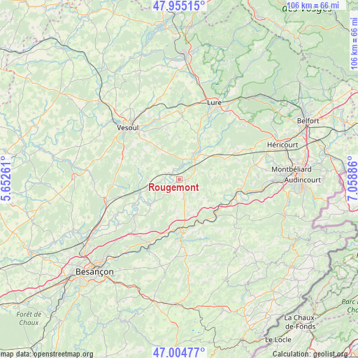
Rougemont GPS coordinates[2]
47° 28' 55.596" North, 6° 21' 20.664" East
| Map corner | latitude | longitude |
|---|---|---|
| Upper-left | 47.95515°, | 5.65261° |
| Center: | 47.48211°, | 6.35574° |
| Lower-right: | 47.00477°, | 7.05886° |
| Map W x H: | 105.7×105.7 km | = 65.7×65.7mi |
| max Lat: | 51.07786° ⇑49.1% North |
| Rougemont: | 47.48211° |
| min Lat: | ⇓50.9% South 41.3874° |
| min Long | Rougemont | max Long |
| -5.08615° | 6.35574° | 9.52242° |
| W 90.7%⇐ | ⇒9.3% E |
Elevation
Elevation of Rougemont is 260 m = 853 ft, and this is 66.3 m = 218 ft above average elevation for this country.
| Max E: |
2333 m = 7654 ft | 23.5% |
| Rougemont | 260 m 853 ft | |
| Avg. | 193.7 m = 635 ft | |
Min E: |
-1 m = -3 ft | 76.5% |
See also: France elevation on elevation.city.
Geographical zone
Rougemont is located in North temperate zone (between Tropic of Cancer and the Arctic Circle). Distance of this North polar circle is 2121.7 km =1318.4 mi to North.| Distance of | km | miles | from Rougemont |
|---|---|---|---|
| North Pole | 4727.5 | 2937.5 | to North |
| Arctic Circle | 2121.7 | 1318.4 | to North |
| Tropic Cancer | 2673.6 | 1661.3 | to South |
| Equator | 5279.5 | 3280.5 | to South |


Nearby cities:
15 places around Rougemont: (largest is in red/bold)
• Athesans-Étroitefontaine
17.8 km =11.1 mi,  42°
42°
• Baume-les-Dames
14.4 km =8.9 mi,  178°
178°
• Clerval
14.8 km =9.2 mi,  132°
132°
• Dampierre-sur-Linotte
9.8 km =6.1 mi,  288°
288°
• Esprels
6.1 km =3.8 mi,  11°
11°
• Frotey-lès-Vesoul
19.9 km =12.4 mi,  320°
320°
• Lusans
18.4 km =11.4 mi,  218°
218°
• Moffans-et-Vacheresse
22 km =13.7 mi, 41°
• Navenne
20.3 km =12.6 mi,  314°
314°
• Quincey
19.3 km =12 mi, 318°
• Roulans
20.8 km =12.9 mi,  207°
207°
• Villers-le-Sec
16.5 km =10.3 mi, 321°
• Villersexel
9.6 km =6 mi, 37°
• Vy-lès-Lure
19.3 km =12 mi,  20°
20°
• Échenoz-la-Méline
21.2 km =13.2 mi, 308°
Sources, notices
• [Note1] Compared only with cities in France existing in our database
• [Src1] Map data: © OpenStreetMap contributors (CC-BY-SA)
• [Src2] Other city data from geonames.org with taken over terms of usage.
• [Src3] Geographical zone / Annual Mean Temperature by Robert A. Rohde @ Wikipedia
