Dampierre-sur-Linotte geodata
Dampierre-sur-Linotte (Bourgogne-Franche-Comté) is a populated place; located in France in Europe/Paris (GMT+2) time zone. With population of 715 people, there are 11591 cities with bigger population in this country. Compared to other cities in France, 51.4% of cities are located further ↓South; 89.6% of cities are located further ←West and 77.3% of cities have lower elevation than Dampierre-sur-Linotte. Note1
Administrative division(s):
- Level 1: Bourgogne-Franche-Comté
- Level 2: Département de la Haute-Saône
- Level 3: Arrondissement de Vesoul
- Level 4: Dampierre-sur-Linotte
Current local time in Dampierre-sur-Linotte:
04:39 AM, WednesdayDifference from your time zone: hours


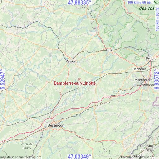
Dampierre-sur-Linotte GPS coordinates[2]
47° 30' 38.052" North, 6° 13' 57.36" East
| Map corner | latitude | longitude |
|---|---|---|
| Upper-left | 47.98335°, | 5.52947° |
| Center: | 47.51057°, | 6.2326° |
| Lower-right: | 47.03349°, | 6.93572° |
| Map W x H: | 105.6×105.6 km | = 65.6×65.6mi |
| max Lat: | 51.07786° ⇑48.6% North |
| Dampierre-sur-Linotte: | 47.51057° |
| min Lat: | ⇓51.4% South 41.3874° |
| min Long | Dampierre-sur-L | max Long |
| -5.08615° | 6.2326° | 9.52242° |
| W 89.6%⇐ | ⇒10.4% E |
Elevation
Elevation of Dampierre-sur-Linotte is 266 m = 873 ft, and this is 72.3 m = 237 ft above average elevation for this country.
| Max E: |
2333 m = 7654 ft | 22.7% |
| Dampierre-sur-Linotte | 266 m 873 ft | |
| Avg. | 193.7 m = 635 ft | |
Min E: |
-1 m = -3 ft | 77.3% |
See also: France elevation on elevation.city.
Geographical zone
Dampierre-sur-Linotte is located in North temperate zone (between Tropic of Cancer and the Arctic Circle). Distance of this North polar circle is 2118.5 km =1316.4 mi to North.| Distance of | km | miles | from Dampierre-sur-Linotte |
|---|---|---|---|
| North Pole | 4724.4 | 2935.6 | to North |
| Arctic Circle | 2118.5 | 1316.4 | to North |
| Tropic Cancer | 2676.8 | 1663.3 | to South |
| Equator | 5282.7 | 3282.5 | to South |


Nearby cities:
15 places around Dampierre-sur-Linotte: (largest is in red/bold)
• Esprels
10.9 km =6.8 mi,  74°
74°
• Frotey-lès-Vesoul
12.7 km =7.9 mi,  344°
344°
• Lusans
17.7 km =11 mi,  187°
187°
• Mailley-et-Chazelot
13.9 km =8.6 mi,  282°
282°
• Navenne
12.1 km =7.5 mi,  334°
334°
• Noidans-lès-Vesoul
13.9 km =8.6 mi,  324°
324°
• Pusey
17.7 km =11 mi, 333°
• Quincey
11.8 km =7.3 mi, 342°
• Rioz
15.7 km =9.8 mi,  232°
232°
• Rougemont
9.8 km =6.1 mi,  108°
108°
• Vaivre-et-Montoille
16.4 km =10.2 mi, 323°
• Vesoul
14.5 km =9 mi, 332°
• Villers-le-Sec
9.9 km =6.2 mi,  354°
354°
• Villersexel
15.7 km =9.8 mi, 73°
• Échenoz-la-Méline
12.4 km =7.7 mi, 324°
Sources, notices
• [Note1] Compared only with cities in France existing in our database
• [Src1] Map data: © OpenStreetMap contributors (CC-BY-SA)
• [Src2] Other city data from geonames.org with taken over terms of usage.
• [Src3] Geographical zone / Annual Mean Temperature by Robert A. Rohde @ Wikipedia
