La Baule-Escoublac geodata
La Baule-Escoublac (Pays de la Loire) is a populated place; located in France in Europe/Paris (GMT+2) time zone. With population of 17,775 people, there are 536 cities with bigger population in this country. Compared to other cities in France, 51.6% of cities are located further ↑North; 95.9% of cities are located further →East and 90.7% of cities have higher elevation than La Baule-Escoublac. Note1
Administrative division(s):
- Level 1: Pays de la Loire
- Level 2: Loire-Atlantique
- Level 3: Arrondissement de Saint-Nazaire
- Level 4: La Baule-Escoublac


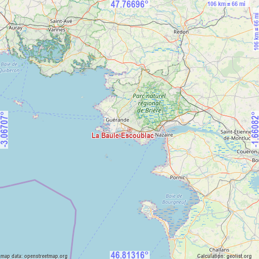
La Baule-Escoublac GPS coordinates[2]
47° 17' 31.956" North, 2° 21' 50.22" West
| Map corner | latitude | longitude |
|---|---|---|
| Upper-left | 47.76696°, | -3.06707° |
| Center: | 47.29221°, | -2.36395° |
| Lower-right: | 46.81316°, | -1.66082° |
| Map W x H: | 106.1×106.1 km | = 65.9×65.9mi |
| max Lat: | 51.07786° ⇑51.6% North |
| La Baule-Escoublac: | 47.29221° |
| min Lat: | ⇓48.4% South 41.3874° |
| min Long | La Baule-Escoub | max Long |
| -5.08615° | -2.36395° | 9.52242° |
| W 4.1%⇐ | ⇒95.9% E |
Elevation
Elevation of La Baule-Escoublac is 28 m = 92 ft, and this is 165.7 m = 544 ft below average elevation for this country.
| Max E: |
2333 m = 7654 ft | 90.7% |
| Avg. | 193.7 m = 635 ft | |
| La Baule-Escoublac | 28 m = 92 ft | |
Min E: |
-1 m = -3 ft | 9.3% |
See also: France elevation on elevation.city.
Geographical zone
La Baule-Escoublac is located in North temperate zone (between Tropic of Cancer and the Arctic Circle). Distance of this North polar circle is 2142.8 km =1331.5 mi to North.| Distance of | km | miles | from La Baule-Escoublac |
|---|---|---|---|
| North Pole | 4748.7 | 2950.7 | to North |
| Arctic Circle | 2142.8 | 1331.5 | to North |
| Tropic Cancer | 2652.5 | 1648.2 | to South |
| Equator | 5258.4 | 3267.4 | to South |


Nearby cities:
15 places around La Baule-Escoublac: (largest is in red/bold)
• Assérac
15.3 km =9.5 mi,  352°
352°
• Batz-sur-Mer
8.9 km =5.5 mi,  259°
259°
• Guérande
6.4 km =4 mi,  310°
310°
• La Turballe
12.4 km =7.7 mi,  299°
299°
• Le Croisic
11.3 km =7 mi,  269°
269°
• Le Pouliguen
5.4 km =3.4 mi,  242°
242°
• Mesquer
13.9 km =8.6 mi,  328°
328°
• Pornichet
3.4 km =2.1 mi,  145°
145°
• Saint-André-des-Eaux
4.7 km =2.9 mi,  58°
58°
• Saint-Brevin-les-Pins
15.6 km =9.7 mi,  107°
107°
• Saint-Lyphard
12.6 km =7.8 mi,  20°
20°
• Saint-Malo-de-Guersac
15.6 km =9.7 mi, 64°
• Saint-Molf
11.9 km =7.4 mi,  337°
337°
• Saint-Nazaire
11.7 km =7.3 mi,  96°
96°
• Trignac
13.5 km =8.4 mi,  77°
77°
Sources, notices
• [Note1] Compared only with cities in France existing in our database
• [Src1] Map data: © OpenStreetMap contributors (CC-BY-SA)
• [Src2] Other city data from geonames.org with taken over terms of usage.
• [Src3] Geographical zone / Annual Mean Temperature by Robert A. Rohde @ Wikipedia
