Mesquer geodata
Mesquer (Pays de la Loire) is a populated place; located in France in Europe/Paris (GMT+2) time zone. With population of 1,585 people, there are 5888 cities with bigger population in this country. Compared to other cities in France, 50.1% of cities are located further ↑North; 96.1% of cities are located further →East and 97.4% of cities have higher elevation than Mesquer. Note1
Administrative division(s):
- Level 1: Pays de la Loire
- Level 2: Loire-Atlantique
- Level 3: Arrondissement de Saint-Nazaire
- Level 4: Mesquer


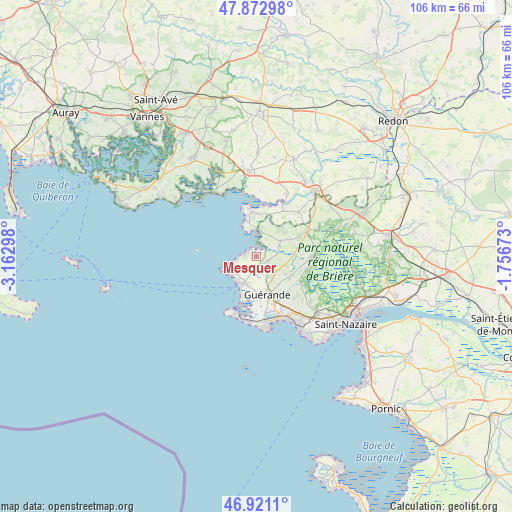
Mesquer GPS coordinates[2]
47° 23' 57.084" North, 2° 27' 35.496" West
| Map corner | latitude | longitude |
|---|---|---|
| Upper-left | 47.87298°, | -3.16298° |
| Center: | 47.39919°, | -2.45986° |
| Lower-right: | 46.9211°, | -1.75673° |
| Map W x H: | 105.8×105.8 km | = 65.7×65.7mi |
| max Lat: | 51.07786° ⇑50.1% North |
| Mesquer: | 47.39919° |
| min Lat: | ⇓49.9% South 41.3874° |
| min Long | Mesquer | max Long |
| -5.08615° | -2.45986° | 9.52242° |
| W 3.9%⇐ | ⇒96.1% E |
Elevation
Elevation of Mesquer is 10 m = 33 ft, and this is 183.7 m = 603 ft below average elevation for this country.
| Max E: |
2333 m = 7654 ft | 97.4% |
| Avg. | 193.7 m = 635 ft | |
| Mesquer | 10 m = 33 ft | |
Min E: |
-1 m = -3 ft | 2.6% |
See also: France elevation on elevation.city.
Geographical zone
Mesquer is located in North temperate zone (between Tropic of Cancer and the Arctic Circle). Distance of this North polar circle is 2130.9 km =1324.1 mi to North.| Distance of | km | miles | from Mesquer |
|---|---|---|---|
| North Pole | 4736.8 | 2943.3 | to North |
| Arctic Circle | 2130.9 | 1324.1 | to North |
| Tropic Cancer | 2664.4 | 1655.6 | to South |
| Equator | 5270.3 | 3274.8 | to South |


Nearby cities:
15 places around Mesquer: (largest is in red/bold)
• Arzal
14.5 km =9 mi,  25°
25°
• Assérac
6.3 km =3.9 mi,  58°
58°
• Batz-sur-Mer
13.6 km =8.5 mi,  186°
186°
• Camoël
10.3 km =6.4 mi, 27°
• Férel
12.8 km =8 mi,  43°
43°
• Guérande
8.1 km =5 mi,  163°
163°
• Herbignac
12 km =7.5 mi, 62°
• La Baule-Escoublac
13.9 km =8.6 mi,  148°
148°
• La Turballe
6.8 km =4.2 mi,  211°
211°
• Le Croisic
12.6 km =7.8 mi,  198°
198°
• Piriac-sur-Mer
6.9 km =4.3 mi,  251°
251°
• Pénestin
9.3 km =5.8 mi,  354°
354°
• Saint-André-des-Eaux
14.6 km =9.1 mi,  129°
129°
• Saint-Lyphard
11.5 km =7.1 mi,  90°
90°
• Saint-Molf
2.9 km =1.8 mi,  107°
107°
Sources, notices
• [Note1] Compared only with cities in France existing in our database
• [Src1] Map data: © OpenStreetMap contributors (CC-BY-SA)
• [Src2] Other city data from geonames.org with taken over terms of usage.
• [Src3] Geographical zone / Annual Mean Temperature by Robert A. Rohde @ Wikipedia
