Saint-Lyphard geodata
Saint-Lyphard (Pays de la Loire) is a populated place; located in France in Europe/Paris (GMT+2) time zone. With population of 3,463 people, there are 2806 cities with bigger population in this country. Compared to other cities in France, 50.1% of cities are located further ↑North; 95.8% of cities are located further →East and 97.4% of cities have higher elevation than Saint-Lyphard. Note1
Administrative division(s):
- Level 1: Pays de la Loire
- Level 2: Loire-Atlantique
- Level 3: Arrondissement de Saint-Nazaire
- Level 4: Saint-Lyphard


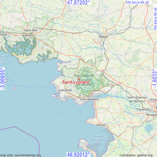
Saint-Lyphard GPS coordinates[2]
47° 23' 53.592" North, 2° 18' 23.112" West
| Map corner | latitude | longitude |
|---|---|---|
| Upper-left | 47.87202°, | -3.00955° |
| Center: | 47.39822°, | -2.30642° |
| Lower-right: | 46.92012°, | -1.6033° |
| Map W x H: | 105.8×105.8 km | = 65.7×65.7mi |
| max Lat: | 51.07786° ⇑50.1% North |
| Saint-Lyphard: | 47.39822° |
| min Lat: | ⇓49.9% South 41.3874° |
| min Long | Saint-Lyphard | max Long |
| -5.08615° | -2.30642° | 9.52242° |
| W 4.2%⇐ | ⇒95.8% E |
Elevation
Elevation of Saint-Lyphard is 10 m = 33 ft, and this is 183.7 m = 603 ft below average elevation for this country.
| Max E: |
2333 m = 7654 ft | 97.4% |
| Avg. | 193.7 m = 635 ft | |
| Saint-Lyphard | 10 m = 33 ft | |
Min E: |
-1 m = -3 ft | 2.6% |
See also: France elevation on elevation.city.
Geographical zone
Saint-Lyphard is located in North temperate zone (between Tropic of Cancer and the Arctic Circle). Distance of this North polar circle is 2131 km =1324.1 mi to North.| Distance of | km | miles | from Saint-Lyphard |
|---|---|---|---|
| North Pole | 4736.9 | 2943.4 | to North |
| Arctic Circle | 2131 | 1324.1 | to North |
| Tropic Cancer | 2664.3 | 1655.5 | to South |
| Equator | 5270.2 | 3274.7 | to South |


Nearby cities:
15 places around Saint-Lyphard: (largest is in red/bold)
• Assérac
7.1 km =4.4 mi,  298°
298°
• Camoël
11.4 km =7.1 mi,  324°
324°
• Crossac
10.4 km =6.5 mi,  82°
82°
• Férel
9.7 km =6 mi,  343°
343°
• Guérande
12 km =7.5 mi,  230°
230°
• Herbignac
5.6 km =3.5 mi,  351°
351°
• La Chapelle-des-Marais
7.6 km =4.7 mi,  42°
42°
• Le Pin
11.8 km =7.3 mi,  116°
116°
• Mesquer
11.5 km =7.1 mi,  270°
270°
• Saint-André-des-Eaux
9.3 km =5.8 mi,  182°
182°
• Saint-Joachim
8.7 km =5.4 mi,  100°
100°
• Saint-Malo-de-Guersac
10.9 km =6.8 mi, 117°
• Saint-Molf
8.8 km =5.5 mi, 265°
• Sainte-Reine-de-Bretagne
9.8 km =6.1 mi,  60°
60°
• Trignac
12.6 km =7.8 mi,  135°
135°
Sources, notices
• [Note1] Compared only with cities in France existing in our database
• [Src1] Map data: © OpenStreetMap contributors (CC-BY-SA)
• [Src2] Other city data from geonames.org with taken over terms of usage.
• [Src3] Geographical zone / Annual Mean Temperature by Robert A. Rohde @ Wikipedia
