Erquinghem-Lys geodata
Erquinghem-Lys (Hauts-de-France) is a populated place; located in France in Europe/Paris (GMT+2) time zone. With population of 4,581 people, there are 2158 cities with bigger population in this country. Compared to other cities in France, 98.7% of cities are located further ↓South; 55.6% of cities are located further ←West and 94.4% of cities have higher elevation than Erquinghem-Lys. Note1
Administrative division(s):
- Level 1: Hauts-de-France
- Level 2: Nord
- Level 3: Arrondissement de Lille
- Level 4: Erquinghem-Lys


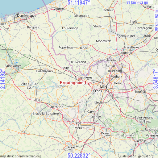
Erquinghem-Lys GPS coordinates[2]
50° 40' 33.636" North, 2° 50' 42.18" East
| Map corner | latitude | longitude |
|---|---|---|
| Upper-left | 51.11947°, | 2.14192° |
| Center: | 50.67601°, | 2.84505° |
| Lower-right: | 50.22832°, | 3.54817° |
| Map W x H: | 99.1×99.1 km | = 61.6×61.6mi |
| max Lat: | 51.07786° ⇑1.3% North |
| Erquinghem-Lys: | 50.67601° |
| min Lat: | ⇓98.7% South 41.3874° |
| min Long | Erquinghem-Lys | max Long |
| -5.08615° | 2.84505° | 9.52242° |
| W 55.6%⇐ | ⇒44.4% E |
Elevation
Elevation of Erquinghem-Lys is 19 m = 62 ft, and this is 174.7 m = 573 ft below average elevation for this country.
| Max E: |
2333 m = 7654 ft | 94.4% |
| Avg. | 193.7 m = 635 ft | |
| Erquinghem-Lys | 19 m = 62 ft | |
Min E: |
-1 m = -3 ft | 5.6% |
See also: France elevation on elevation.city.
Geographical zone
Erquinghem-Lys is located in North temperate zone (between Tropic of Cancer and the Arctic Circle). Distance of this North polar circle is 1766.5 km =1097.7 mi to North.| Distance of | km | miles | from Erquinghem-Lys |
|---|---|---|---|
| North Pole | 4372.4 | 2716.9 | to North |
| Arctic Circle | 1766.5 | 1097.7 | to North |
| Tropic Cancer | 3028.7 | 1881.9 | to South |
| Equator | 5634.6 | 3501.2 | to South |


Nearby cities:
15 places around Erquinghem-Lys: (largest is in red/bold)
• Armentières
2.8 km =1.7 mi,  67°
67°
• Bois-Grenier
3.6 km =2.2 mi,  144°
144°
• Ennetières-en-Weppes
8.1 km =5 mi,  124°
124°
• Fleurbaix
2.9 km =1.8 mi,  196°
196°
• Frelinghien
7.7 km =4.8 mi,  53°
53°
• Fromelles
7.7 km =4.8 mi,  175°
175°
• Houplines
5.4 km =3.4 mi, 66°
• Laventie
7.5 km =4.7 mi,  224°
224°
• Le Maisnil
7.3 km =4.5 mi,  157°
157°
• Nieppe
3.2 km =2 mi,  347°
347°
• Prémesques
7.8 km =4.8 mi,  106°
106°
• Pérenchies
8.8 km =5.5 mi,  94°
94°
• Radinghem-en-Weppes
7.8 km =4.8 mi, 144°
• Sailly-sur-la-Lys
5.7 km =3.5 mi,  249°
249°
• Steenwerck
5.5 km =3.4 mi,  301°
301°
Sources, notices
• [Note1] Compared only with cities in France existing in our database
• [Src1] Map data: © OpenStreetMap contributors (CC-BY-SA)
• [Src2] Other city data from geonames.org with taken over terms of usage.
• [Src3] Geographical zone / Annual Mean Temperature by Robert A. Rohde @ Wikipedia
