Fromelles geodata
Fromelles (Hauts-de-France) is a populated place; located in France in Europe/Paris (GMT+2) time zone. With population of 898 people, there are 9675 cities with bigger population in this country. Compared to other cities in France, 98.1% of cities are located further ↓South; 55.7% of cities are located further ←West and 90.7% of cities have higher elevation than Fromelles. Note1
Administrative division(s):
- Level 1: Hauts-de-France
- Level 2: Nord
- Level 3: Arrondissement de Lille
- Level 4: Fromelles


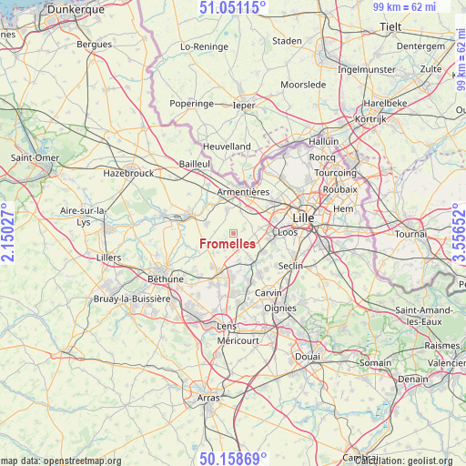
Fromelles GPS coordinates[2]
50° 36' 25.344" North, 2° 51' 12.24" East
| Map corner | latitude | longitude |
|---|---|---|
| Upper-left | 51.05115°, | 2.15027° |
| Center: | 50.60704°, | 2.8534° |
| Lower-right: | 50.15869°, | 3.55652° |
| Map W x H: | 99.2×99.2 km | = 61.6×61.6mi |
| max Lat: | 51.07786° ⇑1.9% North |
| Fromelles: | 50.60704° |
| min Lat: | ⇓98.1% South 41.3874° |
| min Long | Fromelles | max Long |
| -5.08615° | 2.8534° | 9.52242° |
| W 55.7%⇐ | ⇒44.3% E |
Elevation
Elevation of Fromelles is 28 m = 92 ft, and this is 165.7 m = 544 ft below average elevation for this country.
| Max E: |
2333 m = 7654 ft | 90.7% |
| Avg. | 193.7 m = 635 ft | |
| Fromelles | 28 m = 92 ft | |
Min E: |
-1 m = -3 ft | 9.3% |
See also: France elevation on elevation.city.
Geographical zone
Fromelles is located in North temperate zone (between Tropic of Cancer and the Arctic Circle). Distance of this North polar circle is 1774.2 km =1102.4 mi to North.| Distance of | km | miles | from Fromelles |
|---|---|---|---|
| North Pole | 4380.1 | 2721.7 | to North |
| Arctic Circle | 1774.2 | 1102.4 | to North |
| Tropic Cancer | 3021.1 | 1877.2 | to South |
| Equator | 5627 | 3496.5 | to South |


Nearby cities:
15 places around Fromelles: (largest is in red/bold)
• Aubers
2.3 km =1.4 mi,  235°
235°
• Beaucamps-Ligny
4.4 km =2.7 mi,  92°
92°
• Bois-Grenier
5 km =3.1 mi,  17°
17°
• Ennetières-en-Weppes
6.9 km =4.3 mi,  62°
62°
• Fleurbaix
5.1 km =3.2 mi,  343°
343°
• Fournes-en-Weppes
3.5 km =2.2 mi,  135°
135°
• Herlies
3.3 km =2.1 mi,  180°
180°
• Illies
5.3 km =3.3 mi,  197°
197°
• Laventie
6.3 km =3.9 mi,  291°
291°
• Le Maisnil
2.4 km =1.5 mi,  68°
68°
• Lorgies
6.2 km =3.9 mi,  226°
226°
• Marquillies
5.8 km =3.6 mi,  167°
167°
• Neuve-Chapelle
5.6 km =3.5 mi, 244°
• Radinghem-en-Weppes
4.2 km =2.6 mi, 71°
• Sainghin-en-Weppes
5.7 km =3.5 mi,  146°
146°
Sources, notices
• [Note1] Compared only with cities in France existing in our database
• [Src1] Map data: © OpenStreetMap contributors (CC-BY-SA)
• [Src2] Other city data from geonames.org with taken over terms of usage.
• [Src3] Geographical zone / Annual Mean Temperature by Robert A. Rohde @ Wikipedia
