Ercé-près-Liffré geodata
Ercé-près-Liffré (Brittany) is a populated place; located in France in Europe/Paris (GMT+2) time zone. With population of 1,493 people, there are 6213 cities with bigger population in this country. Compared to other cities in France, 63.7% of cities are located further ↓South; 92.4% of cities are located further →East and 77.8% of cities have higher elevation than Ercé-près-Liffré. Note1
Administrative division(s):
- Level 1: Brittany
- Level 2: Département d'Ille-et-Vilaine
- Level 3: Arrondissement de Rennes
- Level 4: Ercé-près-Liffré


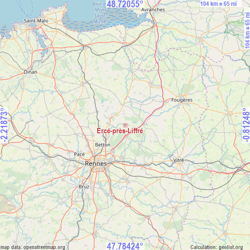
Ercé-près-Liffré GPS coordinates[2]
48° 15' 16.344" North, 1° 30' 56.16" West
| Map corner | latitude | longitude |
|---|---|---|
| Upper-left | 48.72055°, | -2.21873° |
| Center: | 48.25454°, | -1.5156° |
| Lower-right: | 47.78424°, | -0.81248° |
| Map W x H: | 104.1×104.1 km | = 64.7×64.7mi |
| max Lat: | 51.07786° ⇑36.3% North |
| Ercé-près-Liffré: | 48.25454° |
| min Lat: | ⇓63.7% South 41.3874° |
| min Long | Ercé-près-Lif | max Long |
| -5.08615° | -1.5156° | 9.52242° |
| W 7.6%⇐ | ⇒92.4% E |
Elevation
Elevation of Ercé-près-Liffré is 60 m = 197 ft, and this is 133.7 m = 439 ft below average elevation for this country.
| Max E: |
2333 m = 7654 ft | 77.8% |
| Avg. | 193.7 m = 635 ft | |
| Ercé-près-Liffré | 60 m = 197 ft | |
Min E: |
-1 m = -3 ft | 22.2% |
See also: France elevation on elevation.city.
Geographical zone
Ercé-près-Liffré is located in North temperate zone (between Tropic of Cancer and the Arctic Circle). Distance of this North polar circle is 2035.8 km =1265 mi to North.| Distance of | km | miles | from Ercé-près-Liffré |
|---|---|---|---|
| North Pole | 4641.7 | 2884.2 | to North |
| Arctic Circle | 2035.8 | 1265 | to North |
| Tropic Cancer | 2759.5 | 1714.7 | to South |
| Equator | 5365.4 | 3333.9 | to South |


Nearby cities:
15 places around Ercé-près-Liffré: (largest is in red/bold)
• Andouillé-Neuville
6.9 km =4.3 mi,  307°
307°
• Chasné-sur-Illet
3.6 km =2.2 mi,  248°
248°
• Chevaigné
9.7 km =6 mi,  240°
240°
• Gahard
4.8 km =3 mi,  356°
356°
• Gosné
3.8 km =2.4 mi,  103°
103°
• La Bouëxière
10 km =6.2 mi,  142°
142°
• Liffré
4.6 km =2.9 mi,  173°
173°
• Mouazé
7.4 km =4.6 mi, 249°
• Mézières-sur-Couesnon
7.6 km =4.7 mi,  53°
53°
• Saint-Aubin-du-Cormier
8.4 km =5.2 mi,  87°
87°
• Saint-Germain-sur-Ille
10.6 km =6.6 mi,  266°
266°
• Saint-Ouen-des-Alleux
10.5 km =6.5 mi,  39°
39°
• Saint-Sulpice-la-Forêt
6.3 km =3.9 mi,  228°
228°
• Sens-de-Bretagne
8.8 km =5.5 mi,  350°
350°
• Vieux-Vy-sur-Couesnon
9.9 km =6.2 mi,  11°
11°
Sources, notices
• [Note1] Compared only with cities in France existing in our database
• [Src1] Map data: © OpenStreetMap contributors (CC-BY-SA)
• [Src2] Other city data from geonames.org with taken over terms of usage.
• [Src3] Geographical zone / Annual Mean Temperature by Robert A. Rohde @ Wikipedia
