Mézières-sur-Couesnon geodata
Mézières-sur-Couesnon (Brittany) is a populated place; located in France in Europe/Paris (GMT+2) time zone. With population of 894 people, there are 9709 cities with bigger population in this country. Compared to other cities in France, 64.4% of cities are located further ↓South; 91.8% of cities are located further →East and 63.6% of cities have higher elevation than Mézières-sur-Couesnon. Note1
Administrative division(s):
- Level 1: Brittany
- Level 2: Département d'Ille-et-Vilaine
- Level 3: Arrondissement de Rennes
- Level 4: Mézières-sur-Couesnon
Current local time in Mézières-sur-Couesnon:
11:26 PM, SaturdayDifference from your time zone: hours


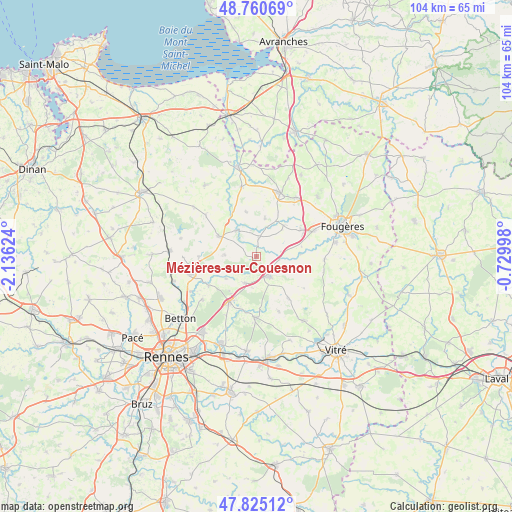
Mézières-sur-Couesnon GPS coordinates[2]
48° 17' 42.18" North, 1° 25' 59.196" West
| Map corner | latitude | longitude |
|---|---|---|
| Upper-left | 48.76069°, | -2.13624° |
| Center: | 48.29505°, | -1.43311° |
| Lower-right: | 47.82512°, | -0.72998° |
| Map W x H: | 104×104 km | = 64.6×64.6mi |
| max Lat: | 51.07786° ⇑35.6% North |
| Mézières-sur-Couesnon: | 48.29505° |
| min Lat: | ⇓64.4% South 41.3874° |
| min Long | Mézières-sur- | max Long |
| -5.08615° | -1.43311° | 9.52242° |
| W 8.2%⇐ | ⇒91.8% E |
Elevation
Elevation of Mézières-sur-Couesnon is 93 m = 305 ft, and this is 100.7 m = 330 ft below average elevation for this country.
| Max E: |
2333 m = 7654 ft | 63.6% |
| Avg. | 193.7 m = 635 ft | |
| Mézières-sur-Couesnon | 93 m = 305 ft | |
Min E: |
-1 m = -3 ft | 36.4% |
See also: France elevation on elevation.city.
Geographical zone
Mézières-sur-Couesnon is located in North temperate zone (between Tropic of Cancer and the Arctic Circle). Distance of this North polar circle is 2031.3 km =1262.2 mi to North.| Distance of | km | miles | from Mézières-sur-Couesnon |
|---|---|---|---|
| North Pole | 4637.2 | 2881.4 | to North |
| Arctic Circle | 2031.3 | 1262.2 | to North |
| Tropic Cancer | 2764 | 1717.5 | to South |
| Equator | 5369.9 | 3336.7 | to South |


Nearby cities:
15 places around Mézières-sur-Couesnon: (largest is in red/bold)
• Chasné-sur-Illet
11.1 km =6.9 mi,  238°
238°
• Chauvigné
9.3 km =5.8 mi,  347°
347°
• Ercé-près-Liffré
7.6 km =4.7 mi,  233°
233°
• Gahard
6.4 km =4 mi,  272°
272°
• Gosné
5.9 km =3.7 mi,  204°
204°
• Liffré
10.7 km =6.6 mi,  211°
211°
• Livré-sur-Changeon
10.7 km =6.6 mi,  142°
142°
• Saint-Aubin-du-Cormier
4.7 km =2.9 mi,  150°
150°
• Saint-Hilaire-des-Landes
8.3 km =5.2 mi,  40°
40°
• Saint-Jean-sur-Couesnon
4.8 km =3 mi,  96°
96°
• Saint-Marc-le-Blanc
8 km =5 mi,  12°
12°
• Saint-Ouen-des-Alleux
3.7 km =2.3 mi, 8°
• Saint-Sauveur-des-Landes
10.4 km =6.5 mi,  59°
59°
• Sens-de-Bretagne
8.6 km =5.3 mi,  298°
298°
• Vieux-Vy-sur-Couesnon
6.6 km =4.1 mi,  321°
321°
Sources, notices
• [Note1] Compared only with cities in France existing in our database
• [Src1] Map data: © OpenStreetMap contributors (CC-BY-SA)
• [Src2] Other city data from geonames.org with taken over terms of usage.
• [Src3] Geographical zone / Annual Mean Temperature by Robert A. Rohde @ Wikipedia
