Saint-Aubin-du-Cormier geodata
Saint-Aubin-du-Cormier (Brittany) is a populated place; located in France in Europe/Paris (GMT+2) time zone. With population of 3,269 people, there are 2985 cities with bigger population in this country. Compared to other cities in France, 63.8% of cities are located further ↓South; 91.5% of cities are located further →East and 56.2% of cities have higher elevation than Saint-Aubin-du-Cormier. Note1
Administrative division(s):
- Level 1: Brittany
- Level 2: Département d'Ille-et-Vilaine
- Level 3: Arrondissement de Rennes
- Level 4: Saint-Aubin-du-Cormier
Current local time in Saint-Aubin-du-Cormier:
11:25 PM, SaturdayDifference from your time zone: hours


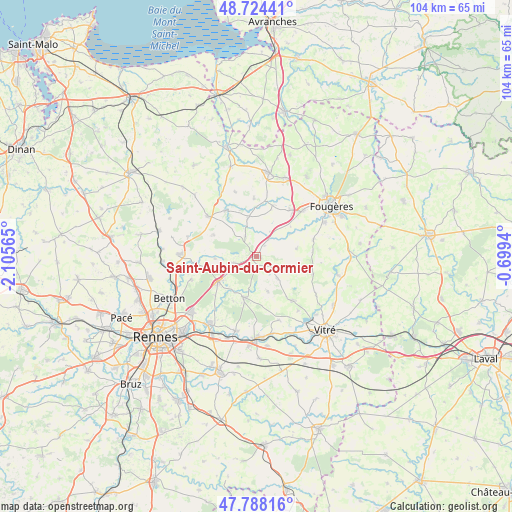
Saint-Aubin-du-Cormier GPS coordinates[2]
48° 15' 30.348" North, 1° 24' 9.072" West
| Map corner | latitude | longitude |
|---|---|---|
| Upper-left | 48.72441°, | -2.10565° |
| Center: | 48.25843°, | -1.40252° |
| Lower-right: | 47.78816°, | -0.6994° |
| Map W x H: | 104.1×104.1 km | = 64.7×64.7mi |
| max Lat: | 51.07786° ⇑36.2% North |
| Saint-Aubin-du-Cormier: | 48.25843° |
| min Lat: | ⇓63.8% South 41.3874° |
| min Long | Saint-Aubin-du- | max Long |
| -5.08615° | -1.40252° | 9.52242° |
| W 8.5%⇐ | ⇒91.5% E |
Elevation
Elevation of Saint-Aubin-du-Cormier is 113 m = 371 ft, and this is 80.7 m = 265 ft below average elevation for this country.
| Max E: |
2333 m = 7654 ft | 56.2% |
| Avg. | 193.7 m = 635 ft | |
| Saint-Aubin-du-Cormier | 113 m = 371 ft | |
Min E: |
-1 m = -3 ft | 43.8% |
See also: France elevation on elevation.city.
Geographical zone
Saint-Aubin-du-Cormier is located in North temperate zone (between Tropic of Cancer and the Arctic Circle). Distance of this North polar circle is 2035.3 km =1264.7 mi to North.| Distance of | km | miles | from Saint-Aubin-du-Cormier |
|---|---|---|---|
| North Pole | 4641.2 | 2883.9 | to North |
| Arctic Circle | 2035.3 | 1264.7 | to North |
| Tropic Cancer | 2759.9 | 1714.9 | to South |
| Equator | 5365.8 | 3334.2 | to South |


Nearby cities:
15 places around Saint-Aubin-du-Cormier: (largest is in red/bold)
• Chasné-sur-Illet
11.9 km =7.4 mi,  261°
261°
• Dourdain
7.7 km =4.8 mi,  161°
161°
• Ercé-près-Liffré
8.4 km =5.2 mi,  267°
267°
• Gahard
9.7 km =6 mi,  296°
296°
• Gosné
4.8 km =3 mi,  254°
254°
• La Bouëxière
8.7 km =5.4 mi,  195°
195°
• Liffré
9.3 km =5.8 mi,  237°
237°
• Livré-sur-Changeon
6.1 km =3.8 mi,  135°
135°
• Mecé
7.8 km =4.8 mi,  107°
107°
• Mézières-sur-Couesnon
4.7 km =2.9 mi,  330°
330°
• Saint-Hilaire-des-Landes
10.9 km =6.8 mi,  17°
17°
• Saint-Jean-sur-Couesnon
4.3 km =2.7 mi,  35°
35°
• Saint-Ouen-des-Alleux
7.9 km =4.9 mi,  347°
347°
• Saint-Sauveur-des-Landes
11.5 km =7.1 mi, 35°
• Vieux-Vy-sur-Couesnon
11.3 km =7 mi, 325°
Sources, notices
• [Note1] Compared only with cities in France existing in our database
• [Src1] Map data: © OpenStreetMap contributors (CC-BY-SA)
• [Src2] Other city data from geonames.org with taken over terms of usage.
• [Src3] Geographical zone / Annual Mean Temperature by Robert A. Rohde @ Wikipedia
