Épron geodata
Épron (Normandy) is a populated place; located in France in Europe/Paris (GMT+2) time zone. With population of 1,861 people, there are 5100 cities with bigger population in this country. Compared to other cities in France, 84.7% of cities are located further ↓South; 81.7% of cities are located further →East and 80.2% of cities have higher elevation than Épron. Note1
Administrative division(s):
- Level 1: Normandy
- Level 2: Calvados
- Level 3: Arrondissement de Caen
- Level 4: Épron


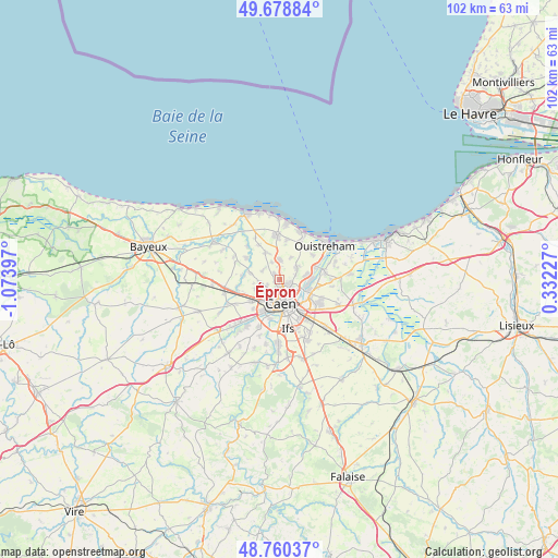
Épron GPS coordinates[2]
49° 13' 18.264" North, 0° 22' 15.06" West
| Map corner | latitude | longitude |
|---|---|---|
| Upper-left | 49.67884°, | -1.07397° |
| Center: | 49.22174°, | -0.37085° |
| Lower-right: | 48.76037°, | 0.33227° |
| Map W x H: | 102.1×102.1 km | = 63.4×63.4mi |
| max Lat: | 51.07786° ⇑15.3% North |
| Épron: | 49.22174° |
| min Lat: | ⇓84.7% South 41.3874° |
| min Long | Épron | max Long |
| -5.08615° | -0.37085° | 9.52242° |
| W 18.3%⇐ | ⇒81.7% E |
Elevation
Elevation of Épron is 54 m = 177 ft, and this is 139.7 m = 458 ft below average elevation for this country.
| Max E: |
2333 m = 7654 ft | 80.2% |
| Avg. | 193.7 m = 635 ft | |
| Épron | 54 m = 177 ft | |
Min E: |
-1 m = -3 ft | 19.8% |
See also: France elevation on elevation.city.
Geographical zone
Épron is located in North temperate zone (between Tropic of Cancer and the Arctic Circle). Distance of this North polar circle is 1928.2 km =1198.1 mi to North.| Distance of | km | miles | from Épron |
|---|---|---|---|
| North Pole | 4534.1 | 2817.4 | to North |
| Arctic Circle | 1928.2 | 1198.1 | to North |
| Tropic Cancer | 2867 | 1781.5 | to South |
| Equator | 5472.9 | 3400.7 | to South |


Nearby cities:
15 places around Épron: (largest is in red/bold)
• Anguerny
5.5 km =3.4 mi,  336°
336°
• Anisy
3.5 km =2.2 mi, 335°
• Authie
4.8 km =3 mi,  248°
248°
• Beuville
4.1 km =2.5 mi,  53°
53°
• Biéville-Beuville
3.9 km =2.4 mi, 53°
• Blainville-sur-Orne
5.2 km =3.2 mi,  80°
80°
• Caen
4.1 km =2.5 mi,  167°
167°
• Cairon
6.1 km =3.8 mi,  289°
289°
• Cambes-en-Plaine
1.5 km =0.9 mi,  316°
316°
• Colombelles
5.8 km =3.6 mi,  108°
108°
• Hérouville-Saint-Clair
4.8 km =3 mi,  104°
104°
• Mathieu
3.6 km =2.2 mi,  358°
358°
• Saint-Contest
2.4 km =1.5 mi, 249°
• Saint-Germain-la-Blanche-Herbe
4.9 km =3 mi,  209°
209°
• Villons-les-Buissons
3.5 km =2.2 mi,  306°
306°
Sources, notices
• [Note1] Compared only with cities in France existing in our database
• [Src1] Map data: © OpenStreetMap contributors (CC-BY-SA)
• [Src2] Other city data from geonames.org with taken over terms of usage.
• [Src3] Geographical zone / Annual Mean Temperature by Robert A. Rohde @ Wikipedia
