Châteauneuf-de-Galaure geodata
Châteauneuf-de-Galaure (Auvergne-Rhône-Alpes) is a populated place; located in France in Europe/Paris (GMT+2) time zone. With population of 1,941 people, there are 4930 cities with bigger population in this country. Compared to other cities in France, 77.1% of cities are located further ↑North; 77.2% of cities are located further ←West and 75.5% of cities have lower elevation than Châteauneuf-de-Galaure. Note1
Administrative division(s):
- Level 1: Auvergne-Rhône-Alpes
- Level 2: Département de la Drôme
- Level 3: Arrondissement de Valence
- Level 4: Châteauneuf-de-Galaure
Current local time in Châteauneuf-de-Galaure:
03:49 PM, SaturdayDifference from your time zone: hours


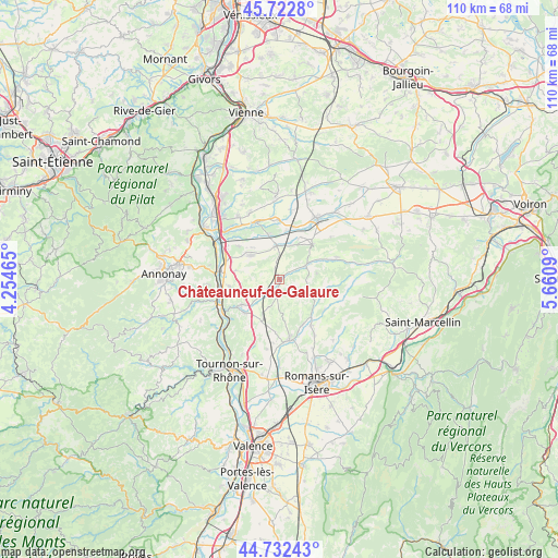
Châteauneuf-de-Galaure GPS coordinates[2]
45° 13' 47.172" North, 4° 57' 27.972" East
| Map corner | latitude | longitude |
|---|---|---|
| Upper-left | 45.7228°, | 4.25465° |
| Center: | 45.22977°, | 4.95777° |
| Lower-right: | 44.73243°, | 5.6609° |
| Map W x H: | 110.1×110.1 km | = 68.4×68.4mi |
| max Lat: | 51.07786° ⇑77.1% North |
| Châteauneuf-de-Galaure: | 45.22977° |
| min Lat: | ⇓22.9% South 41.3874° |
| min Long | Châteauneuf-de | max Long |
| -5.08615° | 4.95777° | 9.52242° |
| W 77.2%⇐ | ⇒22.8% E |
Elevation
Elevation of Châteauneuf-de-Galaure is 253 m = 830 ft, and this is 59.3 m = 195 ft above average elevation for this country.
| Max E: |
2333 m = 7654 ft | 24.5% |
| Châteauneuf-de-Galaure | 253 m 830 ft | |
| Avg. | 193.7 m = 635 ft | |
Min E: |
-1 m = -3 ft | 75.5% |
See also: France elevation on elevation.city.
Geographical zone
Châteauneuf-de-Galaure is located in North temperate zone (between Tropic of Cancer and the Arctic Circle). Distance of this North polar circle is 2372.1 km =1474 mi to North.| Distance of | km | miles | from Châteauneuf-de-Galaure |
|---|---|---|---|
| North Pole | 4978 | 3093.2 | to North |
| Arctic Circle | 2372.1 | 1474 | to North |
| Tropic Cancer | 2423.2 | 1505.7 | to South |
| Equator | 5029.1 | 3124.9 | to South |


Nearby cities:
15 places around Châteauneuf-de-Galaure: (largest is in red/bold)
• Anneyron
7.3 km =4.5 mi,  310°
310°
• Beausemblant
9.9 km =6.2 mi,  261°
261°
• Bren
10.3 km =6.4 mi,  184°
184°
• Claveyson
6 km =3.7 mi,  200°
200°
• Crépol
10.8 km =6.7 mi,  123°
123°
• Hauterives
5.6 km =3.5 mi,  59°
59°
• La Motte-de-Galaure
5.3 km =3.3 mi,  227°
227°
• Lapeyrouse-Mornay
10.8 km =6.7 mi,  15°
15°
• Lens-Lestang
9.7 km =6 mi,  43°
43°
• Manthes
9.3 km =5.8 mi,  26°
26°
• Moras-en-Valloire
7.6 km =4.7 mi, 25°
• Saint-Barthélemy-de-Vals
9.5 km =5.9 mi, 225°
• Saint-Sorlin-en-Valloire
6.5 km =4 mi,  353°
353°
• Saint-Uze
9.2 km =5.7 mi,  236°
236°
• Épinouze
9.2 km =5.7 mi, 346°
Sources, notices
• [Note1] Compared only with cities in France existing in our database
• [Src1] Map data: © OpenStreetMap contributors (CC-BY-SA)
• [Src2] Other city data from geonames.org with taken over terms of usage.
• [Src3] Geographical zone / Annual Mean Temperature by Robert A. Rohde @ Wikipedia
