Anneyron geodata
Anneyron (Auvergne-Rhône-Alpes) is a populated place; located in France in Europe/Paris (GMT+2) time zone. With population of 3,697 people, there are 2660 cities with bigger population in this country. Compared to other cities in France, 76.6% of cities are located further ↑North; 76.3% of cities are located further ←West and 67.8% of cities have lower elevation than Anneyron. Note1
Administrative division(s):
- Level 1: Auvergne-Rhône-Alpes
- Level 2: Département de la Drôme
- Level 3: Arrondissement de Valence
- Level 4: Anneyron


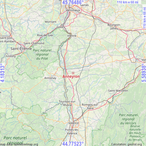
Anneyron GPS coordinates[2]
45° 16' 19.92" North, 4° 53' 10.536" East
| Map corner | latitude | longitude |
|---|---|---|
| Upper-left | 45.76486°, | 4.18313° |
| Center: | 45.2722°, | 4.88626° |
| Lower-right: | 44.77523°, | 5.58938° |
| Map W x H: | 110×110 km | = 68.4×68.4mi |
| max Lat: | 51.07786° ⇑76.6% North |
| Anneyron: | 45.2722° |
| min Lat: | ⇓23.4% South 41.3874° |
| min Long | Anneyron | max Long |
| -5.08615° | 4.88626° | 9.52242° |
| W 76.3%⇐ | ⇒23.7% E |
Elevation
Elevation of Anneyron is 208 m = 682 ft, and this is 14.3 m = 47 ft above average elevation for this country.
| Max E: |
2333 m = 7654 ft | 32.2% |
| Anneyron | 208 m 682 ft | |
| Avg. | 193.7 m = 635 ft | |
Min E: |
-1 m = -3 ft | 67.8% |
See also: France elevation on elevation.city.
Geographical zone
Anneyron is located in North temperate zone (between Tropic of Cancer and the Arctic Circle). Distance of this North polar circle is 2367.4 km =1471 mi to North.| Distance of | km | miles | from Anneyron |
|---|---|---|---|
| North Pole | 4973.3 | 3090.3 | to North |
| Arctic Circle | 2367.4 | 1471 | to North |
| Tropic Cancer | 2427.9 | 1508.6 | to South |
| Equator | 5033.8 | 3127.9 | to South |


Nearby cities:
15 places around Anneyron: (largest is in red/bold)
• Agnin
8 km =5 mi,  341°
341°
• Andance
7.7 km =4.8 mi,  242°
242°
• Andancette
6.6 km =4.1 mi,  246°
246°
• Anjou
8.5 km =5.3 mi,  358°
358°
• Beausemblant
7.4 km =4.6 mi,  214°
214°
• Bougé-Chambalud
6.6 km =4.1 mi,  9°
9°
• Champagne
6.7 km =4.2 mi,  270°
270°
• Chanas
7.4 km =4.6 mi,  314°
314°
• Châteauneuf-de-Galaure
7.3 km =4.5 mi,  130°
130°
• Jarcieu
8.2 km =5.1 mi,  33°
33°
• La Motte-de-Galaure
8.5 km =5.3 mi,  168°
168°
• Laveyron
8.6 km =5.3 mi,  216°
216°
• Saint-Désirat
8.1 km =5 mi,  257°
257°
• Saint-Sorlin-en-Valloire
5.2 km =3.2 mi,  70°
70°
• Épinouze
5.4 km =3.4 mi,  38°
38°
Sources, notices
• [Note1] Compared only with cities in France existing in our database
• [Src1] Map data: © OpenStreetMap contributors (CC-BY-SA)
• [Src2] Other city data from geonames.org with taken over terms of usage.
• [Src3] Geographical zone / Annual Mean Temperature by Robert A. Rohde @ Wikipedia
