Couches geodata
Couches (Bourgogne-Franche-Comté) is a populated place; located in France in Europe/Paris (GMT+2) time zone. With population of 1,420 people, there are 6522 cities with bigger population in this country. Compared to other cities in France, 56.5% of cities are located further ↑North; 72.5% of cities are located further ←West and 87.7% of cities have lower elevation than Couches. Note1
Administrative division(s):
- Level 1: Bourgogne-Franche-Comté
- Level 2: Département de Saône-et-Loire
- Level 3: Autun
- Level 4: Couches


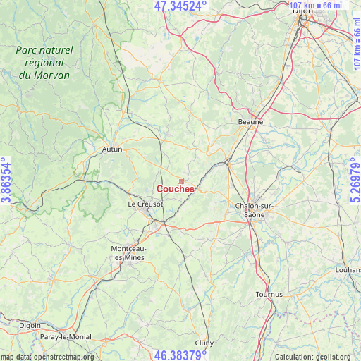
Couches GPS coordinates[2]
46° 52' 0.012" North, 4° 34' 0.012" East
| Map corner | latitude | longitude |
|---|---|---|
| Upper-left | 47.34524°, | 3.86354° |
| Center: | 46.86667°, | 4.56667° |
| Lower-right: | 46.38379°, | 5.26979° |
| Map W x H: | 106.9×106.9 km | = 66.4×66.4mi |
| max Lat: | 51.07786° ⇑56.5% North |
| Couches: | 46.86667° |
| min Lat: | ⇓43.5% South 41.3874° |
| min Long | Couches | max Long |
| -5.08615° | 4.56667° | 9.52242° |
| W 72.5%⇐ | ⇒27.5% E |
Elevation
Elevation of Couches is 384 m = 1260 ft, and this is 190.3 m = 624 ft above average elevation for this country.
| Max E: |
2333 m = 7654 ft | 12.3% |
| Couches | 384 m 1260 ft | |
| Avg. | 193.7 m = 635 ft | |
Min E: |
-1 m = -3 ft | 87.7% |
See also: France elevation on elevation.city.
Geographical zone
Couches is located in North temperate zone (between Tropic of Cancer and the Arctic Circle). Distance of this North polar circle is 2190.1 km =1360.9 mi to North.| Distance of | km | miles | from Couches |
|---|---|---|---|
| North Pole | 4796 | 2980.1 | to North |
| Arctic Circle | 2190.1 | 1360.9 | to North |
| Tropic Cancer | 2605.2 | 1618.8 | to South |
| Equator | 5211.1 | 3238 | to South |


Nearby cities:
15 places around Couches: (largest is in red/bold)
• Antully
12.6 km =7.8 mi,  289°
289°
• Le Breuil
10 km =6.2 mi,  227°
227°
• Le Creusot
13.2 km =8.2 mi,  239°
239°
• Mellecey
13.8 km =8.6 mi,  116°
116°
• Mercurey
11.8 km =7.3 mi,  104°
104°
• Nolay
10.8 km =6.7 mi,  28°
28°
• Rully
13.5 km =8.4 mi,  86°
86°
• Saint-Firmin
8.5 km =5.3 mi, 240°
• Saint-Léger-sur-Dheune
5.8 km =3.6 mi,  114°
114°
• Saint-Pierre-de-Varennes
5.8 km =3.6 mi, 241°
• Saint-Sernin-du-Bois
10.6 km =6.6 mi,  254°
254°
• Saint-Sernin-du-Plain
4.7 km =2.9 mi,  53°
53°
• Santenay
11.1 km =6.9 mi,  62°
62°
• Écuisses
12.5 km =7.8 mi,  189°
189°
• Épinac
13.5 km =8.4 mi,  343°
343°
Sources, notices
• [Note1] Compared only with cities in France existing in our database
• [Src1] Map data: © OpenStreetMap contributors (CC-BY-SA)
• [Src2] Other city data from geonames.org with taken over terms of usage.
• [Src3] Geographical zone / Annual Mean Temperature by Robert A. Rohde @ Wikipedia
