Eckbolsheim geodata
Eckbolsheim (Grand Est) is a populated place; located in France in Europe/Paris (GMT+2) time zone. With population of 6,253 people, there are 1586 cities with bigger population in this country. Compared to other cities in France, 70.4% of cities are located further ↓South; 99% of cities are located further ←West and 53.9% of cities have lower elevation than Eckbolsheim. Note1
Administrative division(s):
- Level 1: Grand Est
- Level 2: Bas-Rhin
- Level 3: Arrondissement de Strasbourg
- Level 4: Eckbolsheim


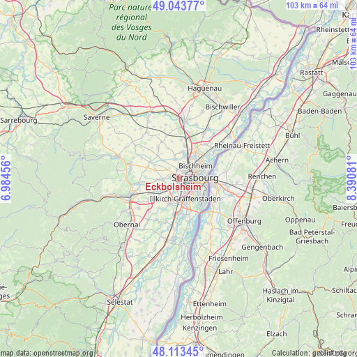
Eckbolsheim GPS coordinates[2]
48° 34' 50.7" North, 7° 41' 15.648" East
| Map corner | latitude | longitude |
|---|---|---|
| Upper-left | 49.04377°, | 6.98456° |
| Center: | 48.58075°, | 7.68768° |
| Lower-right: | 48.11345°, | 8.39081° |
| Map W x H: | 103.4×103.4 km | = 64.2×64.2mi |
| max Lat: | 51.07786° ⇑29.6% North |
| Eckbolsheim: | 48.58075° |
| min Lat: | ⇓70.4% South 41.3874° |
| min Long | Eckbolsheim | max Long |
| -5.08615° | 7.68768° | 9.52242° |
| W 99%⇐ | ⇒1% E |
Elevation
Elevation of Eckbolsheim is 146 m = 479 ft, and this is 47.7 m = 156 ft below average elevation for this country.
| Max E: |
2333 m = 7654 ft | 46.1% |
| Avg. | 193.7 m = 635 ft | |
| Eckbolsheim | 146 m = 479 ft | |
Min E: |
-1 m = -3 ft | 53.9% |
See also: France elevation on elevation.city.
Geographical zone
Eckbolsheim is located in North temperate zone (between Tropic of Cancer and the Arctic Circle). Distance of this North polar circle is 1999.5 km =1242.4 mi to North.| Distance of | km | miles | from Eckbolsheim |
|---|---|---|---|
| North Pole | 4605.4 | 2861.7 | to North |
| Arctic Circle | 1999.5 | 1242.4 | to North |
| Tropic Cancer | 2795.8 | 1737.2 | to South |
| Equator | 5401.7 | 3356.5 | to South |


Nearby cities:
15 places around Eckbolsheim: (largest is in red/bold)
• Achenheim
4.4 km =2.7 mi,  269°
269°
• Bischheim
6.2 km =3.9 mi,  50°
50°
• Dingsheim
5.7 km =3.5 mi,  346°
346°
• Hangenbieten
5.9 km =3.7 mi,  246°
246°
• Holtzheim
4.1 km =2.5 mi,  231°
231°
• Illkirch-Graffenstaden
6.1 km =3.8 mi,  160°
160°
• Lingolsheim
2.6 km =1.6 mi,  188°
188°
• Mittelhausbergen
3.7 km =2.3 mi,  2°
2°
• Niederhausbergen
4.9 km =3 mi,  12°
12°
• Oberhausbergen
2.8 km =1.7 mi, 1°
• Oberschaeffolsheim
2.8 km =1.7 mi,  282°
282°
• Ostwald
4.5 km =2.8 mi, 157°
• Schiltigheim
5.4 km =3.4 mi,  56°
56°
• Strasbourg
4.3 km =2.7 mi,  85°
85°
• Wolfisheim
1.7 km =1.1 mi,  295°
295°
Sources, notices
• [Note1] Compared only with cities in France existing in our database
• [Src1] Map data: © OpenStreetMap contributors (CC-BY-SA)
• [Src2] Other city data from geonames.org with taken over terms of usage.
• [Src3] Geographical zone / Annual Mean Temperature by Robert A. Rohde @ Wikipedia
