Ostwald geodata
Ostwald (Grand Est) is a populated place; located in France in Europe/Paris (GMT+2) time zone. With population of 11,261 people, there are 853 cities with bigger population in this country. Compared to other cities in France, 69.4% of cities are located further ↓South; 99.1% of cities are located further ←West and 52.8% of cities have lower elevation than Ostwald. Note1
Administrative division(s):
- Level 1: Grand Est
- Level 2: Bas-Rhin
- Level 3: Arrondissement de Strasbourg
- Level 4: Ostwald


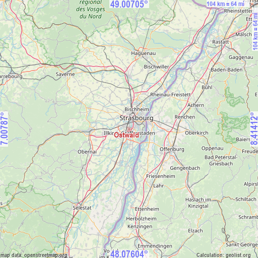
Ostwald GPS coordinates[2]
48° 32' 37.284" North, 7° 42' 39.564" East
| Map corner | latitude | longitude |
|---|---|---|
| Upper-left | 49.00705°, | 7.00787° |
| Center: | 48.54369°, | 7.71099° |
| Lower-right: | 48.07604°, | 8.41412° |
| Map W x H: | 103.5×103.5 km | = 64.3×64.3mi |
| max Lat: | 51.07786° ⇑30.6% North |
| Ostwald: | 48.54369° |
| min Lat: | ⇓69.4% South 41.3874° |
| min Long | Ostwald | max Long |
| -5.08615° | 7.71099° | 9.52242° |
| W 99.1%⇐ | ⇒0.90000000000001% E |
Elevation
Elevation of Ostwald is 142 m = 466 ft, and this is 51.7 m = 170 ft below average elevation for this country.
| Max E: |
2333 m = 7654 ft | 47.2% |
| Avg. | 193.7 m = 635 ft | |
| Ostwald | 142 m = 466 ft | |
Min E: |
-1 m = -3 ft | 52.8% |
See also: France elevation on elevation.city.
Geographical zone
Ostwald is located in North temperate zone (between Tropic of Cancer and the Arctic Circle). Distance of this North polar circle is 2003.6 km =1245 mi to North.| Distance of | km | miles | from Ostwald |
|---|---|---|---|
| North Pole | 4609.5 | 2864.2 | to North |
| Arctic Circle | 2003.6 | 1245 | to North |
| Tropic Cancer | 2791.6 | 1734.6 | to South |
| Equator | 5397.6 | 3353.9 | to South |


Nearby cities:
15 places around Ostwald: (largest is in red/bold)
• Achenheim
7.4 km =4.6 mi,  303°
303°
• Eckbolsheim
4.5 km =2.8 mi,  337°
337°
• Entzheim
5.5 km =3.4 mi,  258°
258°
• Eschau
6.1 km =3.8 mi,  176°
176°
• Fegersheim
6.3 km =3.9 mi,  200°
200°
• Geispolsheim
5.5 km =3.4 mi,  236°
236°
• Hangenbieten
7.3 km =4.5 mi,  284°
284°
• Holtzheim
5.2 km =3.2 mi,  288°
288°
• Illkirch-Graffenstaden
1.7 km =1.1 mi,  169°
169°
• Lingolsheim
2.6 km =1.6 mi,  306°
306°
• Lipsheim
6.6 km =4.1 mi,  208°
208°
• Oberhausbergen
7.1 km =4.4 mi,  346°
346°
• Oberschaeffolsheim
6.5 km =4 mi,  316°
316°
• Strasbourg
5.1 km =3.2 mi,  29°
29°
• Wolfisheim
5.8 km =3.6 mi,  326°
326°
Sources, notices
• [Note1] Compared only with cities in France existing in our database
• [Src1] Map data: © OpenStreetMap contributors (CC-BY-SA)
• [Src2] Other city data from geonames.org with taken over terms of usage.
• [Src3] Geographical zone / Annual Mean Temperature by Robert A. Rohde @ Wikipedia
