Schiltigheim geodata
Schiltigheim (Grand Est) is a populated place; located in France in Europe/Paris (GMT+2) time zone. With population of 32,289 people, there are 243 cities with bigger population in this country. Compared to other cities in France, 71% of cities are located further ↓South; 99.2% of cities are located further ←West and 53.3% of cities have lower elevation than Schiltigheim. Note1
Administrative division(s):
- Level 1: Grand Est
- Level 2: Bas-Rhin
- Level 3: Arrondissement de Strasbourg
- Level 4: Schiltigheim


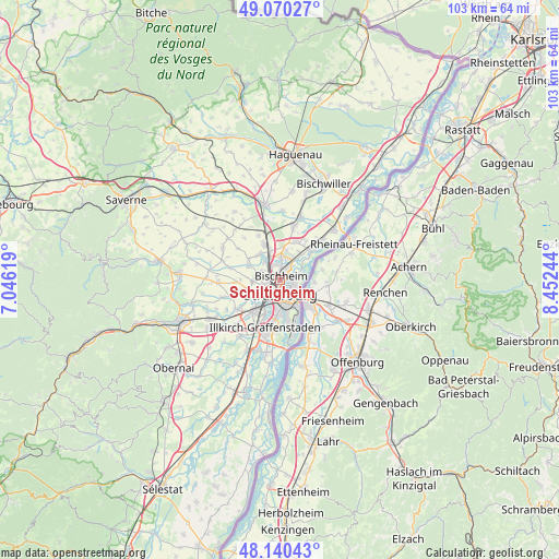
Schiltigheim GPS coordinates[2]
48° 36' 26.964" North, 7° 44' 57.516" East
| Map corner | latitude | longitude |
|---|---|---|
| Upper-left | 49.07027°, | 7.04619° |
| Center: | 48.60749°, | 7.74931° |
| Lower-right: | 48.14043°, | 8.45244° |
| Map W x H: | 103.4×103.4 km | = 64.2×64.2mi |
| max Lat: | 51.07786° ⇑29% North |
| Schiltigheim: | 48.60749° |
| min Lat: | ⇓71% South 41.3874° |
| min Long | Schiltigheim | max Long |
| -5.08615° | 7.74931° | 9.52242° |
| W 99.2%⇐ | ⇒0.8% E |
Elevation
Elevation of Schiltigheim is 144 m = 472 ft, and this is 49.7 m = 163 ft below average elevation for this country.
| Max E: |
2333 m = 7654 ft | 46.7% |
| Avg. | 193.7 m = 635 ft | |
| Schiltigheim | 144 m = 472 ft | |
Min E: |
-1 m = -3 ft | 53.3% |
See also: France elevation on elevation.city.
Geographical zone
Schiltigheim is located in North temperate zone (between Tropic of Cancer and the Arctic Circle). Distance of this North polar circle is 1996.5 km =1240.6 mi to North.| Distance of | km | miles | from Schiltigheim |
|---|---|---|---|
| North Pole | 4602.4 | 2859.8 | to North |
| Arctic Circle | 1996.5 | 1240.6 | to North |
| Tropic Cancer | 2798.7 | 1739 | to South |
| Equator | 5404.6 | 3358.3 | to South |


Nearby cities:
15 places around Schiltigheim: (largest is in red/bold)
• Bischheim
1 km =0.6 mi,  17°
17°
• Dingsheim
6.4 km =4 mi,  293°
293°
• Eckbolsheim
5.4 km =3.4 mi,  236°
236°
• Griesheim-sur-Souffel
6.7 km =4.2 mi,  298°
298°
• Hœnheim
1.7 km =1.1 mi, 15°
• Lampertheim
6.1 km =3.8 mi,  322°
322°
• Mittelhausbergen
4.4 km =2.7 mi,  279°
279°
• Mundolsheim
4.7 km =2.9 mi,  325°
325°
• Niederhausbergen
3.9 km =2.4 mi, 297°
• Oberhausbergen
4.5 km =2.8 mi,  267°
267°
• Pfulgriesheim
7.1 km =4.4 mi,  305°
305°
• Reichstett
4.6 km =2.9 mi,  4°
4°
• Souffelweyersheim
3.2 km =2 mi,  349°
349°
• Strasbourg
2.6 km =1.6 mi,  186°
186°
• Wolfisheim
6.5 km =4 mi,  249°
249°
Sources, notices
• [Note1] Compared only with cities in France existing in our database
• [Src1] Map data: © OpenStreetMap contributors (CC-BY-SA)
• [Src2] Other city data from geonames.org with taken over terms of usage.
• [Src3] Geographical zone / Annual Mean Temperature by Robert A. Rohde @ Wikipedia
